Imelda geodata
Imelda (Bicol) is a populated place; located in Philippines in Asia/Manila (GMT+8) time zone. With population of 3,466 people, there are 2086 cities with bigger population in this country. Compared to other cities in Philippines, 69.5% of cities are located further ↓South; 51.3% of cities are located further ←West and 85.4% of cities have lower elevation than Imelda. Note1
Administrative division(s):
- Level 1: Bicol
- Level 2: Province of Camarines Norte
- Level 3: San Lorenzo Ruiz (Imelda)


Imelda GPS coordinates[2]
14° 1' 59.988" North, 122° 52' 59.988" East
| Map corner | latitude | longitude |
|---|---|---|
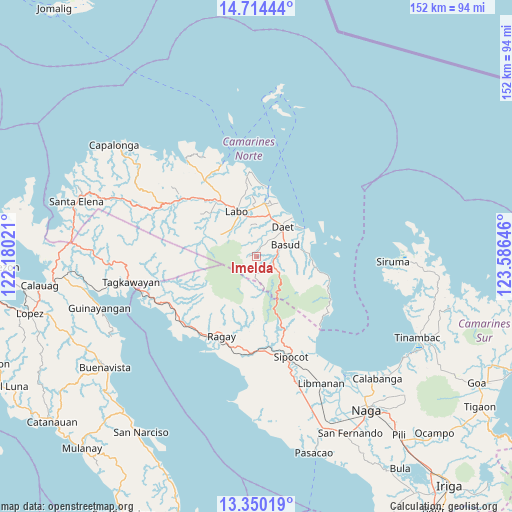
| Upper-left | 14.71444°, | 122.18021° |
| Center: | 14.03333°, | 122.88333° |
| Lower-right: | 13.35019°, | 123.58646° |
| Map W x H: | 151.7×151.7 km | = 94.3×94.3mi |
| max Lat: | 20.78733° ⇑30.5% North |
| Imelda: | 14.03333° |
| min Lat: | ⇓69.5% South 4.65442° |
| min Long | Imelda | max Long |
| 117.04868° | 122.88333° | 126.58417° |
| W 51.3%⇐ | ⇒48.7% E |
Elevation
Elevation of Imelda is 143 m = 469 ft, and this is 55.1 m = 181 ft above average elevation for this country.
| Max E: |
2262 m = 7421 ft | 14.6% |
| Imelda | 143 m 469 ft | |
| Avg. | 87.9 m = 288 ft | |
Min E: |
-2 m = -7 ft | 85.4% |
See also: Philippines elevation on elevation.city.
Geographical zone
Imelda is located in North Torrid zone (between Equator and Tropic of Cancer). Distance of this Northern Tropic circle is 1045.6 km =649.7 mi to North.| Distance of | km | miles | from Imelda |
|---|---|---|---|
| North Pole | 8446.7 | 5248.5 | to North |
| Arctic Circle | 5840.8 | 3629.3 | to North |
| Tropic Cancer | 1045.6 | 649.7 | to North |
| Equator | 1560.4 | 969.6 | to South |


Nearby cities:
15 places around Imelda: (largest is in red/bold)
• Basud
9.4 km =5.8 mi,  68°
68°
• Calasgasan
7.7 km =4.8 mi,  44°
44°
• Daet
11.7 km =7.3 mi, 41°
• Dugongan
8.1 km =5 mi,  18°
18°
• Guinacotan
13.8 km =8.6 mi,  353°
353°
• Labo
14.5 km =9 mi,  336°
336°
• Lugui
13.1 km =8.1 mi,  312°
312°
• Malasugui
12.9 km =8 mi, 342°
• Mampurog
1.4 km =0.9 mi,  1°
1°
• Matnog
6.5 km =4 mi,  55°
55°
• San Felipe
5.2 km =3.2 mi,  108°
108°
• San Vicente
8.2 km =5.1 mi, 352°
• Santo Domingo
11.2 km =7 mi, 2°
• Talisay
12 km =7.5 mi, 20°
• Tulay na Lupa
12.4 km =7.7 mi,  302°
302°
Sources, notices
• [Note1] Compared only with cities in Philippines existing in our database
• [Src1] Map data: © OpenStreetMap contributors (CC-BY-SA)
• [Src2] Other city data from geonames.org with taken over terms of usage.
• [Src3] Geographical zone / Annual Mean Temperature by Robert A. Rohde @ Wikipedia
