Labo geodata
Labo (Bicol) is a seat of a third-order administrative division; located in Philippines in Asia/Manila (GMT+8) time zone. With population of 18,105 people, there are 392 cities with bigger population in this country. Compared to other cities in Philippines, 71.1% of cities are located further ↓South; 50.3% of cities are located further ←West and 57.6% of cities have higher elevation than Labo. Note1


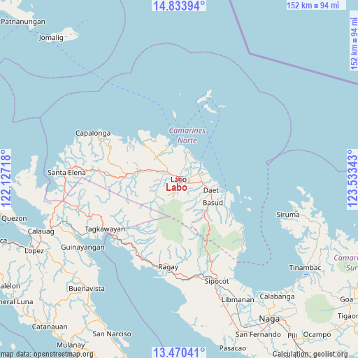
Labo GPS coordinates[2]
14° 9' 11.52" North, 122° 49' 49.08" East
| Map corner | latitude | longitude |
|---|---|---|
| Upper-left | 14.83394°, | 122.12718° |
| Center: | 14.1532°, | 122.8303° |
| Lower-right: | 13.47041°, | 123.53343° |
| Map W x H: | 151.6×151.6 km | = 94.2×94.2mi |
| max Lat: | 20.78733° ⇑28.9% North |
| Labo: | 14.1532° |
| min Lat: | ⇓71.1% South 4.65442° |
| min Long | Labo | max Long |
| 117.04868° | 122.8303° | 126.58417° |
| W 50.3%⇐ | ⇒49.7% E |
Elevation
Elevation of Labo is 18 m = 59 ft, and this is 69.9 m = 229 ft below average elevation for this country.
| Max E: |
2262 m = 7421 ft | 57.6% |
| Avg. | 87.9 m = 288 ft | |
| Labo | 18 m = 59 ft | |
Min E: |
-2 m = -7 ft | 42.4% |
See also: Philippines elevation on elevation.city.
Geographical zone
Labo is located in North Torrid zone (between Equator and Tropic of Cancer). Distance of this Northern Tropic circle is 1032.2 km =641.4 mi to North.| Distance of | km | miles | from Labo |
|---|---|---|---|
| North Pole | 8433.4 | 5240.3 | to North |
| Arctic Circle | 5827.5 | 3621 | to North |
| Tropic Cancer | 1032.2 | 641.4 | to North |
| Equator | 1573.7 | 977.9 | to South |


Nearby cities:
15 places around Labo: (largest is in red/bold)
• Batobalane
12.4 km =7.7 mi,  315°
315°
• Calasgasan
13.6 km =8.5 mi,  124°
124°
• Daguit
11.9 km =7.4 mi,  289°
289°
• Dugongan
10 km =6.2 mi, 124°
• Guinacotan
4.1 km =2.5 mi,  84°
84°
• Lugui
6 km =3.7 mi,  221°
221°
• Malasugui
2.1 km =1.3 mi, 119°
• Mampurog
13.3 km =8.3 mi,  154°
154°
• Sabang Indan
11.7 km =7.3 mi,  51°
51°
• San Vicente
7 km =4.3 mi,  138°
138°
• Santo Domingo
6.6 km =4.1 mi,  109°
109°
• Talisay
10.2 km =6.3 mi,  101°
101°
• Talubatib
5.8 km =3.6 mi,  303°
303°
• Tulay na Lupa
8.2 km =5.1 mi, 215°
• Vinzons
8.5 km =5.3 mi,  74°
74°
Sources, notices
• [Note1] Compared only with cities in Philippines existing in our database
• [Src1] Map data: © OpenStreetMap contributors (CC-BY-SA)
• [Src2] Other city data from geonames.org with taken over terms of usage.
• [Src3] Geographical zone / Annual Mean Temperature by Robert A. Rohde @ Wikipedia
