Santo Tomas geodata
Santo Tomas (Cagayan Valley) is a seat of a third-order administrative division; located in Philippines in Asia/Manila (GMT+8) time zone. With population of 2,772 people, there are 2837 cities with bigger population in this country. Compared to other cities in Philippines, 95.5% of cities are located further ↓South; 63.1% of cities are located further →East and 59.5% of cities have lower elevation than Santo Tomas. Note1
Administrative division(s):
- Level 1: Cagayan Valley
- Level 2: Province of Isabela
- Level 3: Santo Tomas


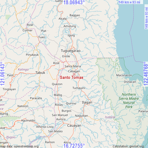
Santo Tomas GPS coordinates[2]
17° 23' 58.992" North, 121° 45' 52.38" East
| Map corner | latitude | longitude |
|---|---|---|
| Upper-left | 18.06943°, | 121.06143° |
| Center: | 17.39972°, | 121.76455° |
| Lower-right: | 16.72755°, | 122.46768° |
| Map W x H: | 149.2×149.2 km | = 92.7×92.7mi |
| max Lat: | 20.78733° ⇑4.5% North |
| Santo Tomas: | 17.39972° |
| min Lat: | ⇓95.5% South 4.65442° |
| min Long | Santo Tomas | max Long |
| 117.04868° | 121.76455° | 126.58417° |
| W 36.9%⇐ | ⇒63.1% E |
Elevation
Elevation of Santo Tomas is 33 m = 108 ft, and this is 54.9 m = 180 ft below average elevation for this country.
| Max E: |
2262 m = 7421 ft | 40.5% |
| Avg. | 87.9 m = 288 ft | |
| Santo Tomas | 33 m = 108 ft | |
Min E: |
-2 m = -7 ft | 59.5% |
See also: Philippines elevation on elevation.city.
Geographical zone
Santo Tomas is located in North Torrid zone (between Equator and Tropic of Cancer). Distance of this Northern Tropic circle is 671.3 km =417.1 mi to North.| Distance of | km | miles | from Santo Tomas |
|---|---|---|---|
| North Pole | 8072.4 | 5016 | to North |
| Arctic Circle | 5466.5 | 3396.7 | to North |
| Tropic Cancer | 671.3 | 417.1 | to North |
| Equator | 1934.7 | 1202.2 | to South |


Nearby cities:
15 places around Santo Tomas: (largest is in red/bold)
• Bangad
10.7 km =6.6 mi,  7°
7°
• Binguang
7.3 km =4.5 mi,  26°
26°
• Bulu
7.4 km =4.6 mi,  178°
178°
• Cabagan
3.2 km =2 mi, 9°
• Calamagui East
9.8 km =6.1 mi,  2°
2°
• Calinaoan Malasin
5.9 km =3.7 mi,  205°
205°
• Magsaysay
10.3 km =6.4 mi,  172°
172°
• Masipi West
8.2 km =5.1 mi,  106°
106°
• Minanga Norte
6.3 km =3.9 mi,  20°
20°
• Mozzozzin Sur
6.6 km =4.1 mi,  342°
342°
• Pilig
6.4 km =4 mi, 171°
• Ragan Norte
8.6 km =5.3 mi, 173°
• San Bernardo
1.5 km =0.9 mi,  292°
292°
• San Juan
1.9 km =1.2 mi, 289°
• Santa Maria
7.5 km =4.7 mi,  349°
349°
Sources, notices
• [Note1] Compared only with cities in Philippines existing in our database
• [Src1] Map data: © OpenStreetMap contributors (CC-BY-SA)
• [Src2] Other city data from geonames.org with taken over terms of usage.
• [Src3] Geographical zone / Annual Mean Temperature by Robert A. Rohde @ Wikipedia
