Santo Tomas geodata
Santo Tomas (Ilocos) is a seat of a third-order administrative division; located in Philippines in Asia/Manila (GMT+8) time zone. In our database, there are 4166 cities with bigger population. Compared to other cities in Philippines, 89.7% of cities are located further ↓South; 94.3% of cities are located further →East and 85.4% of cities have higher elevation than Santo Tomas. Note1


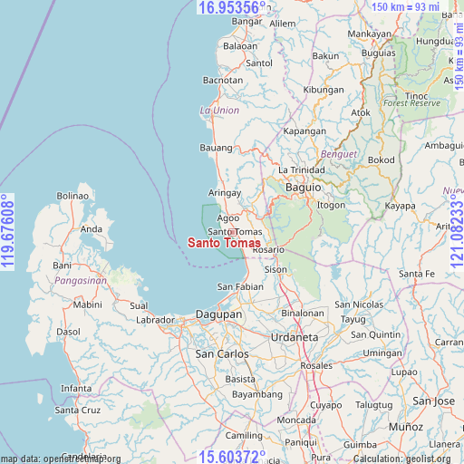
Santo Tomas GPS coordinates[2]
16° 16' 47.28" North, 120° 22' 45.12" East
| Map corner | latitude | longitude |
|---|---|---|
| Upper-left | 16.95356°, | 119.67608° |
| Center: | 16.2798°, | 120.3792° |
| Lower-right: | 15.60372°, | 121.08233° |
| Map W x H: | 150.1×150.1 km | = 93.3×93.3mi |
| max Lat: | 20.78733° ⇑10.3% North |
| Santo Tomas: | 16.2798° |
| min Lat: | ⇓89.7% South 4.65442° |
| min Long | Santo Tomas | max Long |
| 117.04868° | 120.3792° | 126.58417° |
| W 5.7%⇐ | ⇒94.3% E |
Elevation
Elevation of Santo Tomas is 8 m = 26 ft, and this is 79.9 m = 262 ft below average elevation for this country.
| Max E: |
2262 m = 7421 ft | 85.4% |
| Avg. | 87.9 m = 288 ft | |
| Santo Tomas | 8 m = 26 ft | |
Min E: |
-2 m = -7 ft | 14.6% |
See also: Philippines elevation on elevation.city.
Geographical zone
Santo Tomas is located in North Torrid zone (between Equator and Tropic of Cancer). Distance of this Northern Tropic circle is 795.8 km =494.5 mi to North.| Distance of | km | miles | from Santo Tomas |
|---|---|---|---|
| North Pole | 8196.9 | 5093.3 | to North |
| Arctic Circle | 5591 | 3474.1 | to North |
| Tropic Cancer | 795.8 | 494.5 | to North |
| Equator | 1810.1 | 1124.7 | to South |


Nearby cities:
15 places around Santo Tomas: (largest is in red/bold)
• Agoo
5 km =3.1 mi,  344°
344°
• Aringay
13 km =8.1 mi,  348°
348°
• Bail
2.4 km =1.5 mi,  71°
71°
• Caronoan West
7.4 km =4.6 mi,  104°
104°
• Damortis
5.2 km =3.2 mi,  147°
147°
• Halog West
10.4 km =6.5 mi,  21°
21°
• Inabaan Sur
10.7 km =6.6 mi, 100°
• Leones East
9.4 km =5.8 mi,  8°
8°
• Lloren
8.2 km =5.1 mi,  44°
44°
• Macalva Norte
7.7 km =4.8 mi, 5°
• Namboongan
2.6 km =1.6 mi, 352°
• Pugo
10.5 km =6.5 mi,  63°
63°
• Rosario
12.7 km =7.9 mi,  115°
115°
• San Eugenio
9.2 km =5.7 mi, 345°
• Tubao
8.4 km =5.2 mi, 24°
Sources, notices
• [Note1] Compared only with cities in Philippines existing in our database
• [Src1] Map data: © OpenStreetMap contributors (CC-BY-SA)
• [Src2] Other city data from geonames.org with taken over terms of usage.
• [Src3] Geographical zone / Annual Mean Temperature by Robert A. Rohde @ Wikipedia
