Aringay geodata
Aringay (Ilocos) is a seat of a third-order administrative division; located in Philippines in Asia/Manila (GMT+8) time zone. With population of 29,825 people, there are 278 cities with bigger population in this country. Compared to other cities in Philippines, 90.5% of cities are located further ↓South; 94.7% of cities are located further →East and 60.8% of cities have higher elevation than Aringay. Note1


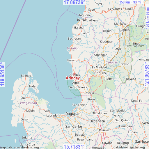
Aringay GPS coordinates[2]
16° 23' 38.4" North, 120° 21' 16.2" East
| Map corner | latitude | longitude |
|---|---|---|
| Upper-left | 17.06736°, | 119.65138° |
| Center: | 16.394°, | 120.3545° |
| Lower-right: | 15.71831°, | 121.05763° |
| Map W x H: | 150×150 km | = 93.2×93.2mi |
| max Lat: | 20.78733° ⇑9.5% North |
| Aringay: | 16.394° |
| min Lat: | ⇓90.5% South 4.65442° |
| min Long | Aringay | max Long |
| 117.04868° | 120.3545° | 126.58417° |
| W 5.3%⇐ | ⇒94.7% E |
Elevation
Elevation of Aringay is 16 m = 52 ft, and this is 71.9 m = 236 ft below average elevation for this country.
| Max E: |
2262 m = 7421 ft | 60.8% |
| Avg. | 87.9 m = 288 ft | |
| Aringay | 16 m = 52 ft | |
Min E: |
-2 m = -7 ft | 39.2% |
See also: Philippines elevation on elevation.city.
Geographical zone
Aringay is located in North Torrid zone (between Equator and Tropic of Cancer). Distance of this Northern Tropic circle is 783.1 km =486.6 mi to North.| Distance of | km | miles | from Aringay |
|---|---|---|---|
| North Pole | 8184.2 | 5085.4 | to North |
| Arctic Circle | 5578.3 | 3466.2 | to North |
| Tropic Cancer | 783.1 | 486.6 | to North |
| Equator | 1822.8 | 1132.6 | to South |


Nearby cities:
15 places around Aringay: (largest is in red/bold)
• Acao
14.8 km =9.2 mi,  9°
9°
• Agoo
8 km =5 mi,  170°
170°
• Bail
12.9 km =8 mi,  157°
157°
• Caba
4.3 km =2.7 mi,  345°
345°
• Halog West
7.1 km =4.4 mi,  115°
115°
• Leones East
5.3 km =3.3 mi,  130°
130°
• Lloren
10.8 km =6.7 mi, 128°
• Macalva Norte
6.1 km =3.8 mi,  145°
145°
• Namboongan
10.3 km =6.4 mi, 167°
• Nangalisan
13.9 km =8.6 mi,  71°
71°
• Payocpoc Sur
11.5 km =7.1 mi, 345°
• Pugo
14.4 km =8.9 mi, 123°
• San Eugenio
3.8 km =2.4 mi,  175°
175°
• Santo Tomas
13 km =8.1 mi, 168°
• Tubao
8 km =5 mi, 129°
Sources, notices
• [Note1] Compared only with cities in Philippines existing in our database
• [Src1] Map data: © OpenStreetMap contributors (CC-BY-SA)
• [Src2] Other city data from geonames.org with taken over terms of usage.
• [Src3] Geographical zone / Annual Mean Temperature by Robert A. Rohde @ Wikipedia
