San Jorge geodata
San Jorge (Eastern Visayas) is a seat of a third-order administrative division; located in Philippines in Asia/Manila (GMT+8) time zone. In our database, there are 4166 cities with bigger population. Compared to other cities in Philippines, 51.7% of cities are located further ↓South; 85% of cities are located further ←West and 73.2% of cities have higher elevation than San Jorge. Note1


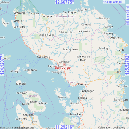
San Jorge GPS coordinates[2]
11° 58' 50.988" North, 124° 49' 26.004" East
| Map corner | latitude | longitude |
|---|---|---|
| Upper-left | 12.66775°, | 124.12077° |
| Center: | 11.98083°, | 124.82389° |
| Lower-right: | 11.29216°, | 125.52702° |
| Map W x H: | 153×153 km | = 95.1×95.1mi |
| max Lat: | 20.78733° ⇑48.3% North |
| San Jorge: | 11.98083° |
| min Lat: | ⇓51.7% South 4.65442° |
| min Long | San Jorge | max Long |
| 117.04868° | 124.82389° | 126.58417° |
| W 85%⇐ | ⇒15% E |
Elevation
Elevation of San Jorge is 11 m = 36 ft, and this is 76.9 m = 252 ft below average elevation for this country.
| Max E: |
2262 m = 7421 ft | 73.2% |
| Avg. | 87.9 m = 288 ft | |
| San Jorge | 11 m = 36 ft | |
Min E: |
-2 m = -7 ft | 26.8% |
See also: Philippines elevation on elevation.city.
Geographical zone
San Jorge is located in North Torrid zone (between Equator and Tropic of Cancer). Distance of this Northern Tropic circle is 1273.8 km =791.5 mi to North.| Distance of | km | miles | from San Jorge |
|---|---|---|---|
| North Pole | 8674.9 | 5390.3 | to North |
| Arctic Circle | 6069 | 3771.1 | to North |
| Tropic Cancer | 1273.8 | 791.5 | to North |
| Equator | 1332.1 | 827.7 | to South |


Nearby cities:
15 places around San Jorge: (largest is in red/bold)
• Calape
21.9 km =13.6 mi,  101°
101°
• Calbayog City
26.5 km =16.5 mi,  291°
291°
• Catbalogan
23.8 km =14.8 mi,  163°
163°
• Gandara
3.8 km =2.4 mi,  339°
339°
• Jiabong
28 km =17.4 mi,  150°
150°
• Motiong
29.4 km =18.3 mi,  139°
139°
• Napuro
13.6 km =8.5 mi, 292°
• Pagsanghan
11.3 km =7 mi,  261°
261°
• Pangdan
28.2 km =17.5 mi, 158°
• San Jose de Buan
23.3 km =14.5 mi,  69°
69°
• San Policarpio
29.3 km =18.2 mi, 289°
• Santa Margarita
19.1 km =11.9 mi, 289°
• Silanga
18.2 km =11.3 mi,  173°
173°
• Tarangnan
12.3 km =7.6 mi,  223°
223°
• Tutubigan
30.2 km =18.8 mi,  121°
121°
Sources, notices
• [Note1] Compared only with cities in Philippines existing in our database
• [Src1] Map data: © OpenStreetMap contributors (CC-BY-SA)
• [Src2] Other city data from geonames.org with taken over terms of usage.
• [Src3] Geographical zone / Annual Mean Temperature by Robert A. Rohde @ Wikipedia
