Pangdan geodata
Pangdan (Eastern Visayas) is a populated place; located in Philippines in Asia/Manila (GMT+8) time zone. With population of 2,597 people, there are 3112 cities with bigger population in this country. Compared to other cities in Philippines, 50.6% of cities are located further ↓South; 86.5% of cities are located further ←West and 80.7% of cities have higher elevation than Pangdan. Note1
Administrative division(s):
- Level 1: Eastern Visayas
- Level 2: Province of Samar
- Level 3: City of Catbalogan


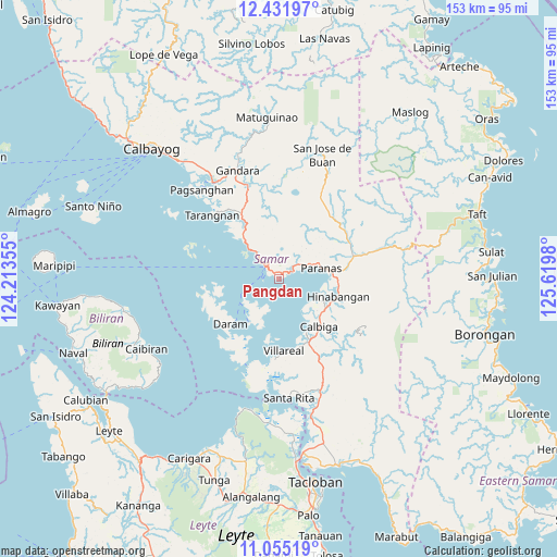
Pangdan GPS coordinates[2]
11° 44' 39.984" North, 124° 55' 0.012" East
| Map corner | latitude | longitude |
|---|---|---|
| Upper-left | 12.43197°, | 124.21355° |
| Center: | 11.74444°, | 124.91667° |
| Lower-right: | 11.05519°, | 125.6198° |
| Map W x H: | 153.1×153.1 km | = 95.1×95.1mi |
| max Lat: | 20.78733° ⇑49.4% North |
| Pangdan: | 11.74444° |
| min Lat: | ⇓50.6% South 4.65442° |
| min Long | Pangdan | max Long |
| 117.04868° | 124.91667° | 126.58417° |
| W 86.5%⇐ | ⇒13.5% E |
Elevation
Elevation of Pangdan is 9 m = 30 ft, and this is 78.9 m = 259 ft below average elevation for this country.
| Max E: |
2262 m = 7421 ft | 80.7% |
| Avg. | 87.9 m = 288 ft | |
| Pangdan | 9 m = 30 ft | |
Min E: |
-2 m = -7 ft | 19.3% |
See also: Philippines elevation on elevation.city.
Geographical zone
Pangdan is located in North Torrid zone (between Equator and Tropic of Cancer). Distance of this Northern Tropic circle is 1300.1 km =807.8 mi to North.| Distance of | km | miles | from Pangdan |
|---|---|---|---|
| North Pole | 8701.2 | 5406.7 | to North |
| Arctic Circle | 6095.3 | 3787.4 | to North |
| Tropic Cancer | 1300.1 | 807.8 | to North |
| Equator | 1305.9 | 811.4 | to South |


Nearby cities:
15 places around Pangdan: (largest is in red/bold)
• Calape
24.8 km =15.4 mi,  27°
27°
• Calbiga
17.2 km =10.7 mi,  140°
140°
• Catbalogan
4.8 km =3 mi,  315°
315°
• Daram
18.1 km =11.2 mi,  227°
227°
• Jiabong
4.3 km =2.7 mi,  62°
62°
• Motiong
9.9 km =6.2 mi,  66°
66°
• Paranas
24.6 km =15.3 mi, 61°
• San Sebastian
11.7 km =7.3 mi,  109°
109°
• Silanga
11.5 km =7.1 mi, 315°
• Talalora
25.5 km =15.8 mi,  200°
200°
• Tarangnan
25.5 km =15.8 mi,  313°
313°
• Tutubigan
19 km =11.8 mi, 56°
• Villareal
19.9 km =12.4 mi,  176°
176°
• Wright
11.8 km =7.3 mi,  75°
75°
• Zumarraga
14.3 km =8.9 mi,  214°
214°
Sources, notices
• [Note1] Compared only with cities in Philippines existing in our database
• [Src1] Map data: © OpenStreetMap contributors (CC-BY-SA)
• [Src2] Other city data from geonames.org with taken over terms of usage.
• [Src3] Geographical zone / Annual Mean Temperature by Robert A. Rohde @ Wikipedia
