Sandolot geodata
Sandolot (Central Visayas) is a populated place; located in Philippines in Asia/Manila (GMT+8) time zone. With population of 3,641 people, there are 1956 cities with bigger population in this country. Compared to other cities in Philippines, 75.2% of cities are located further ↑North; 53.6% of cities are located further ←West and 53.5% of cities have lower elevation than Sandolot. Note1
Administrative division(s):
- Level 1: Central Visayas
- Level 2: Province of Negros Oriental
- Level 3: Siaton


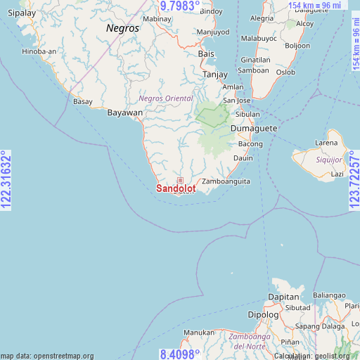
Sandolot GPS coordinates[2]
9° 6' 16.992" North, 123° 1' 9.984" East
| Map corner | latitude | longitude |
|---|---|---|
| Upper-left | 9.7983°, | 122.31632° |
| Center: | 9.10472°, | 123.01944° |
| Lower-right: | 8.4098°, | 123.72257° |
| Map W x H: | 154.4×154.4 km | = 95.9×95.9mi |
| max Lat: | 20.78733° ⇑75.2% North |
| Sandolot: | 9.10472° |
| min Lat: | ⇓24.8% South 4.65442° |
| min Long | Sandolot | max Long |
| 117.04868° | 123.01944° | 126.58417° |
| W 53.6%⇐ | ⇒46.4% E |
Elevation
Elevation of Sandolot is 26 m = 85 ft, and this is 61.9 m = 203 ft below average elevation for this country.
| Max E: |
2262 m = 7421 ft | 46.5% |
| Avg. | 87.9 m = 288 ft | |
| Sandolot | 26 m = 85 ft | |
Min E: |
-2 m = -7 ft | 53.5% |
See also: Philippines elevation on elevation.city.
Geographical zone
Sandolot is located in North Torrid zone (between Equator and Tropic of Cancer). Distance of Equator is 1012.3 km =629 mi to South.| Distance of | km | miles | from Sandolot |
|---|---|---|---|
| North Pole | 8994.7 | 5589 | to North |
| Arctic Circle | 6388.8 | 3969.8 | to North |
| Tropic Cancer | 1593.6 | 990.2 | to North |
| Equator | 1012.3 | 629 | to South |


Nearby cities:
15 places around Sandolot: (largest is in red/bold)
• Alangilan
24.8 km =15.4 mi,  321°
321°
• Apoya
18 km =11.2 mi, 315°
• Bonawon
11.5 km =7.1 mi,  286°
286°
• Cabangahan
8.5 km =5.3 mi,  249°
249°
• Canauay
5.7 km =3.5 mi,  140°
140°
• Casala-an
3.6 km =2.2 mi,  68°
68°
• Caticugan
2.2 km =1.4 mi,  256°
256°
• Maloh
6.6 km =4.1 mi,  214°
214°
• Malway
22.3 km =13.9 mi,  82°
82°
• Manalongon
19.5 km =12.1 mi,  311°
311°
• Mantiquil
7.7 km =4.8 mi,  25°
25°
• Mayabon
17 km =10.6 mi,  93°
93°
• Nagbalaye
22.5 km =14 mi, 315°
• Siaton
4.7 km =2.9 mi,  160°
160°
• Zamboanguita
19.8 km =12.3 mi, 90°
Sources, notices
• [Note1] Compared only with cities in Philippines existing in our database
• [Src1] Map data: © OpenStreetMap contributors (CC-BY-SA)
• [Src2] Other city data from geonames.org with taken over terms of usage.
• [Src3] Geographical zone / Annual Mean Temperature by Robert A. Rohde @ Wikipedia
