Mantiquil geodata
Mantiquil (Central Visayas) is a populated place; located in Philippines in Asia/Manila (GMT+8) time zone. With population of 2,281 people, there are 3719 cities with bigger population in this country. Compared to other cities in Philippines, 74.8% of cities are located further ↑North; 54.1% of cities are located further ←West and 92.3% of cities have lower elevation than Mantiquil. Note1
Administrative division(s):
- Level 1: Central Visayas
- Level 2: Province of Negros Oriental
- Level 3: Siaton


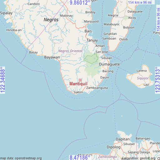
Mantiquil GPS coordinates[2]
9° 10' 0.012" North, 123° 3' 0" East
| Map corner | latitude | longitude |
|---|---|---|
| Upper-left | 9.86012°, | 122.34688° |
| Center: | 9.16667°, | 123.05° |
| Lower-right: | 8.47186°, | 123.75313° |
| Map W x H: | 154.4×154.4 km | = 95.9×95.9mi |
| max Lat: | 20.78733° ⇑74.8% North |
| Mantiquil: | 9.16667° |
| min Lat: | ⇓25.2% South 4.65442° |
| min Long | Mantiquil | max Long |
| 117.04868° | 123.05° | 126.58417° |
| W 54.1%⇐ | ⇒45.9% E |
Elevation
Elevation of Mantiquil is 298 m = 978 ft, and this is 210.1 m = 689 ft above average elevation for this country.
| Max E: |
2262 m = 7421 ft | 7.7% |
| Mantiquil | 298 m 978 ft | |
| Avg. | 87.9 m = 288 ft | |
Min E: |
-2 m = -7 ft | 92.3% |
See also: Philippines elevation on elevation.city.
Geographical zone
Mantiquil is located in North Torrid zone (between Equator and Tropic of Cancer). Distance of Equator is 1019.2 km =633.3 mi to South.| Distance of | km | miles | from Mantiquil |
|---|---|---|---|
| North Pole | 8987.8 | 5584.8 | to North |
| Arctic Circle | 6381.9 | 3965.5 | to North |
| Tropic Cancer | 1586.7 | 985.9 | to North |
| Equator | 1019.2 | 633.3 | to South |


Nearby cities:
15 places around Mantiquil: (largest is in red/bold)
• Apoya
17 km =10.6 mi,  290°
290°
• Bonawon
14.8 km =9.2 mi,  255°
255°
• Cabangahan
15 km =9.3 mi,  228°
228°
• Canauay
11.3 km =7 mi,  178°
178°
• Casala-an
5.6 km =3.5 mi, 180°
• Caticugan
9.2 km =5.7 mi,  216°
216°
• Maayong Tubig
21.6 km =13.4 mi,  89°
89°
• Maloh
14.2 km =8.8 mi,  210°
210°
• Malway
19.1 km =11.9 mi,  101°
101°
• Manalongon
19 km =11.8 mi, 288°
• Mayabon
15.7 km =9.8 mi,  119°
119°
• Nagbalaye
21.2 km =13.2 mi,  295°
295°
• Sandolot
7.7 km =4.8 mi, 205°
• Siaton
11.5 km =7.1 mi,  188°
188°
• Zamboanguita
17.9 km =11.1 mi,  113°
113°
Sources, notices
• [Note1] Compared only with cities in Philippines existing in our database
• [Src1] Map data: © OpenStreetMap contributors (CC-BY-SA)
• [Src2] Other city data from geonames.org with taken over terms of usage.
• [Src3] Geographical zone / Annual Mean Temperature by Robert A. Rohde @ Wikipedia
