Sadsalan geodata
Sadsalan (Soccsksargen) is a populated place; located in Philippines in Asia/Manila (GMT+8) time zone. With population of 2,275 people, there are 3735 cities with bigger population in this country. Compared to other cities in Philippines, 93.1% of cities are located further ↑North; 81% of cities are located further ←West and 56.1% of cities have higher elevation than Sadsalan. Note1
Administrative division(s):
- Level 1: Soccsksargen
- Level 2: Province of Sultan Kudarat
- Level 3: Lambayong (Mariano Marcos)


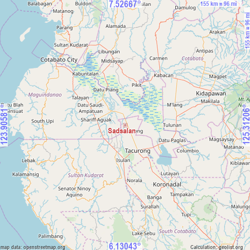
Sadsalan GPS coordinates[2]
6° 49' 44.616" North, 124° 36' 32.148" East
| Map corner | latitude | longitude |
|---|---|---|
| Upper-left | 7.52667°, | 123.90581° |
| Center: | 6.82906°, | 124.60893° |
| Lower-right: | 6.13043°, | 125.31206° |
| Map W x H: | 155.2×155.3 km | = 96.4×96.5mi |
| max Lat: | 20.78733° ⇑93.1% North |
| Sadsalan: | 6.82906° |
| min Lat: | ⇓6.9% South 4.65442° |
| min Long | Sadsalan | max Long |
| 117.04868° | 124.60893° | 126.58417° |
| W 81%⇐ | ⇒19% E |
Elevation
Elevation of Sadsalan is 19 m = 62 ft, and this is 68.9 m = 226 ft below average elevation for this country.
| Max E: |
2262 m = 7421 ft | 56.1% |
| Avg. | 87.9 m = 288 ft | |
| Sadsalan | 19 m = 62 ft | |
Min E: |
-2 m = -7 ft | 43.9% |
See also: Philippines elevation on elevation.city.
Geographical zone
Sadsalan is located in North Torrid zone (between Equator and Tropic of Cancer). Distance of Equator is 759.3 km =471.8 mi to South.| Distance of | km | miles | from Sadsalan |
|---|---|---|---|
| North Pole | 9247.7 | 5746.3 | to North |
| Arctic Circle | 6641.9 | 4127.1 | to North |
| Tropic Cancer | 1846.6 | 1147.4 | to North |
| Equator | 759.3 | 471.8 | to South |


Nearby cities:
15 places around Sadsalan: (largest is in red/bold)
• Badak
12.5 km =7.8 mi,  80°
80°
• Barurao
7.8 km =4.8 mi,  350°
350°
• Gansing
13.2 km =8.2 mi,  158°
158°
• Mamali
7.5 km =4.7 mi,  145°
145°
• Mariano Marcos
12.4 km =7.7 mi, 149°
• Mileb
8.2 km =5.1 mi,  340°
340°
• New Lagao
14.5 km =9 mi,  165°
165°
• New Panay
11.1 km =6.9 mi,  209°
209°
• Panadtaban
8.8 km =5.5 mi,  25°
25°
• Pidsandawan
11.6 km =7.2 mi, 350°
• Pimbalayan
8.3 km =5.2 mi,  57°
57°
• Sagasa
7.2 km =4.5 mi, 212°
• Sambuluan
11.7 km =7.3 mi, 59°
• Sampao
5.5 km =3.4 mi, 344°
• Tambak
11.6 km =7.2 mi, 172°
Sources, notices
• [Note1] Compared only with cities in Philippines existing in our database
• [Src1] Map data: © OpenStreetMap contributors (CC-BY-SA)
• [Src2] Other city data from geonames.org with taken over terms of usage.
• [Src3] Geographical zone / Annual Mean Temperature by Robert A. Rohde @ Wikipedia
