Mamali geodata
Mamali (Soccsksargen) is a populated place; located in Philippines in Asia/Manila (GMT+8) time zone. With population of 2,394 people, there are 3475 cities with bigger population in this country. Compared to other cities in Philippines, 93.4% of cities are located further ↑North; 81.6% of cities are located further ←West and 57.4% of cities have lower elevation than Mamali. Note1
Administrative division(s):
- Level 1: Soccsksargen
- Level 2: Province of Sultan Kudarat
- Level 3: Lambayong (Mariano Marcos)


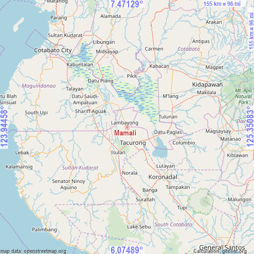
Mamali GPS coordinates[2]
6° 46' 24.96" North, 124° 38' 51.72" East
| Map corner | latitude | longitude |
|---|---|---|
| Upper-left | 7.47129°, | 123.94458° |
| Center: | 6.7736°, | 124.6477° |
| Lower-right: | 6.07489°, | 125.35083° |
| Map W x H: | 155.3×155.3 km | = 96.5×96.5mi |
| max Lat: | 20.78733° ⇑93.4% North |
| Mamali: | 6.7736° |
| min Lat: | ⇓6.6% South 4.65442° |
| min Long | Mamali | max Long |
| 117.04868° | 124.6477° | 126.58417° |
| W 81.6%⇐ | ⇒18.4% E |
Elevation
Elevation of Mamali is 30 m = 98 ft, and this is 57.9 m = 190 ft below average elevation for this country.
| Max E: |
2262 m = 7421 ft | 42.6% |
| Avg. | 87.9 m = 288 ft | |
| Mamali | 30 m = 98 ft | |
Min E: |
-2 m = -7 ft | 57.4% |
See also: Philippines elevation on elevation.city.
Geographical zone
Mamali is located in North Torrid zone (between Equator and Tropic of Cancer). Distance of Equator is 753.2 km =468 mi to South.| Distance of | km | miles | from Mamali |
|---|---|---|---|
| North Pole | 9253.9 | 5750.1 | to North |
| Arctic Circle | 6648 | 4130.9 | to North |
| Tropic Cancer | 1852.8 | 1151.3 | to North |
| Equator | 753.2 | 468 | to South |


Nearby cities:
15 places around Mamali: (largest is in red/bold)
• Badak
11.5 km =7.1 mi,  44°
44°
• Gansing
6.2 km =3.9 mi,  174°
174°
• Kapingkong
11.2 km =7 mi,  192°
192°
• Katico
9.4 km =5.8 mi,  99°
99°
• Mariano Marcos
4.9 km =3 mi,  154°
154°
• Matiompong
12.5 km =7.8 mi,  226°
226°
• New Lagao
8 km =5 mi, 185°
• New Panay
10.3 km =6.4 mi,  250°
250°
• Pimbalayan
11 km =6.8 mi,  14°
14°
• President Quirino
12.6 km =7.8 mi,  128°
128°
• Sadsalan
7.5 km =4.7 mi,  325°
325°
• Sagasa
8.1 km =5 mi,  270°
270°
• Sampao
12.8 km =8 mi, 333°
• Tacurong
9.6 km =6 mi,  160°
160°
• Tambak
6 km =3.7 mi,  206°
206°
Sources, notices
• [Note1] Compared only with cities in Philippines existing in our database
• [Src1] Map data: © OpenStreetMap contributors (CC-BY-SA)
• [Src2] Other city data from geonames.org with taken over terms of usage.
• [Src3] Geographical zone / Annual Mean Temperature by Robert A. Rohde @ Wikipedia
