Pidsandawan geodata
Pidsandawan (Autonomous Region in Muslim Mindanao) is a populated place; located in Philippines in Asia/Manila (GMT+8) time zone. With population of 2,481 people, there are 3327 cities with bigger population in this country. Compared to other cities in Philippines, 92.4% of cities are located further ↑North; 80.6% of cities are located further ←West and 76.6% of cities have higher elevation than Pidsandawan. Note1
Administrative division(s):
- Level 1: Autonomous Region in Muslim Mindanao
- Level 2: Province of Maguindanao
- Level 3: Sultan Sa Barongis (Lambayong)


Pidsandawan GPS coordinates[2]
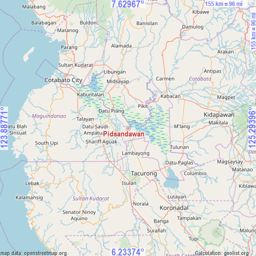
6° 55' 55.992" North, 124° 35' 26.988" East
| Map corner | latitude | longitude |
|---|---|---|
| Upper-left | 7.62967°, | 123.88771° |
| Center: | 6.93222°, | 124.59083° |
| Lower-right: | 6.23374°, | 125.29396° |
| Map W x H: | 155.2×155.2 km | = 96.4×96.4mi |
| max Lat: | 20.78733° ⇑92.4% North |
| Pidsandawan: | 6.93222° |
| min Lat: | ⇓7.6% South 4.65442° |
| min Long | Pidsandawan | max Long |
| 117.04868° | 124.59083° | 126.58417° |
| W 80.6%⇐ | ⇒19.4% E |
Elevation
Elevation of Pidsandawan is 10 m = 33 ft, and this is 77.9 m = 256 ft below average elevation for this country.
| Max E: |
2262 m = 7421 ft | 76.6% |
| Avg. | 87.9 m = 288 ft | |
| Pidsandawan | 10 m = 33 ft | |
Min E: |
-2 m = -7 ft | 23.4% |
See also: Philippines elevation on elevation.city.
Geographical zone
Pidsandawan is located in North Torrid zone (between Equator and Tropic of Cancer). Distance of Equator is 770.8 km =479 mi to South.| Distance of | km | miles | from Pidsandawan |
|---|---|---|---|
| North Pole | 9236.3 | 5739.2 | to North |
| Arctic Circle | 6630.4 | 4119.9 | to North |
| Tropic Cancer | 1835.1 | 1140.3 | to North |
| Equator | 770.8 | 479 | to South |


Nearby cities:
15 places around Pidsandawan: (largest is in red/bold)
• Ampatuan
15.5 km =9.6 mi,  241°
241°
• Barurao
3.9 km =2.4 mi,  169°
169°
• Buliok
15.3 km =9.5 mi,  52°
52°
• Damabalas
12.5 km =7.8 mi,  317°
317°
• Datu Piang
14.5 km =9 mi, 317°
• Kalbugan
8.1 km =5 mi,  67°
67°
• Manaulanan
13.3 km =8.3 mi,  13°
13°
• Mileb
3.8 km =2.4 mi,  191°
191°
• Pagatin
13.5 km =8.4 mi,  289°
289°
• Panadtaban
6.7 km =4.2 mi,  121°
121°
• Pimbalayan
11.4 km =7.1 mi,  127°
127°
• Punolu
13.1 km =8.1 mi,  356°
356°
• Sadsalan
11.6 km =7.2 mi, 170°
• Sambuluan
13.2 km =8.2 mi,  114°
114°
• Sampao
6.2 km =3.9 mi,  175°
175°
Sources, notices
• [Note1] Compared only with cities in Philippines existing in our database
• [Src1] Map data: © OpenStreetMap contributors (CC-BY-SA)
• [Src2] Other city data from geonames.org with taken over terms of usage.
• [Src3] Geographical zone / Annual Mean Temperature by Robert A. Rohde @ Wikipedia
