Porac geodata
Porac (Central Luzon) is a seat of a third-order administrative division; located in Philippines in Asia/Manila (GMT+8) time zone. With population of 21,660 people, there are 354 cities with bigger population in this country. Compared to other cities in Philippines, 78.3% of cities are located further ↓South; 89.8% of cities are located further →East and 76.2% of cities have lower elevation than Porac. Note1


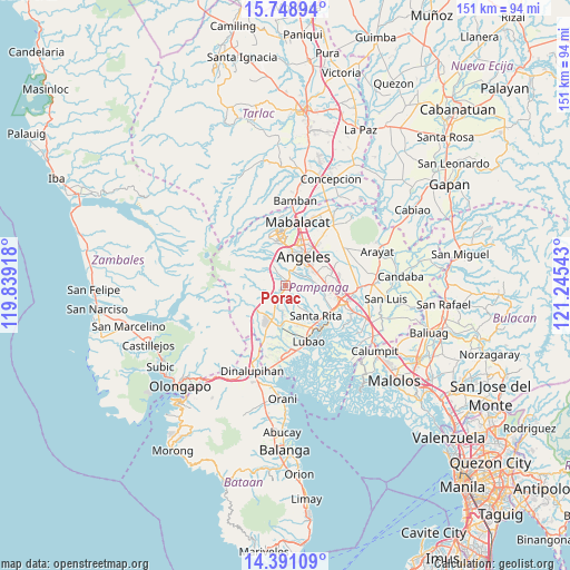
Porac GPS coordinates[2]
15° 4' 15.96" North, 120° 32' 32.28" East
| Map corner | latitude | longitude |
|---|---|---|
| Upper-left | 15.74894°, | 119.83918° |
| Center: | 15.0711°, | 120.5423° |
| Lower-right: | 14.39109°, | 121.24543° |
| Map W x H: | 151×151 km | = 93.8×93.8mi |
| max Lat: | 20.78733° ⇑21.7% North |
| Porac: | 15.0711° |
| min Lat: | ⇓78.3% South 4.65442° |
| min Long | Porac | max Long |
| 117.04868° | 120.5423° | 126.58417° |
| W 10.2%⇐ | ⇒89.8% E |
Elevation
Elevation of Porac is 73 m = 240 ft, and this is 14.9 m = 49 ft below average elevation for this country.
| Max E: |
2262 m = 7421 ft | 23.8% |
| Avg. | 87.9 m = 288 ft | |
| Porac | 73 m = 240 ft | |
Min E: |
-2 m = -7 ft | 76.2% |
See also: Philippines elevation on elevation.city.
Geographical zone
Porac is located in North Torrid zone (between Equator and Tropic of Cancer). Distance of this Northern Tropic circle is 930.2 km =578 mi to North.| Distance of | km | miles | from Porac |
|---|---|---|---|
| North Pole | 8331.3 | 5176.8 | to North |
| Arctic Circle | 5725.4 | 3557.6 | to North |
| Tropic Cancer | 930.2 | 578 | to North |
| Equator | 1675.7 | 1041.2 | to South |


Nearby cities:
15 places around Porac: (largest is in red/bold)
• Angeles City
9.8 km =6.1 mi,  26°
26°
• Babo-Pangulo
3.1 km =1.9 mi,  296°
296°
• Balas
5.3 km =3.3 mi,  116°
116°
• Calantas
6.3 km =3.9 mi,  204°
204°
• Calibutbut
7.7 km =4.8 mi,  50°
50°
• Del Carmen
7.4 km =4.6 mi,  186°
186°
• Dolores
3 km =1.9 mi,  331°
331°
• Manibaug Pasig
3.7 km =2.3 mi,  40°
40°
• Maquiapo
9.7 km =6 mi,  169°
169°
• Pias
6.4 km =4 mi,  160°
160°
• Pio
3.6 km =2.2 mi,  223°
223°
• Pulung Santol
3.5 km =2.2 mi,  143°
143°
• Pulungmasle
8 km =5 mi, 168°
• San Basilio
6.2 km =3.9 mi,  132°
132°
• Telabastagan
8.8 km =5.5 mi, 53°
Sources, notices
• [Note1] Compared only with cities in Philippines existing in our database
• [Src1] Map data: © OpenStreetMap contributors (CC-BY-SA)
• [Src2] Other city data from geonames.org with taken over terms of usage.
• [Src3] Geographical zone / Annual Mean Temperature by Robert A. Rohde @ Wikipedia
