Balas geodata
Balas (Central Luzon) is a populated place; located in Philippines in Asia/Manila (GMT+8) time zone. With population of 2,517 people, there are 3258 cities with bigger population in this country. Compared to other cities in Philippines, 78.2% of cities are located further ↓South; 88.6% of cities are located further →East and 67.5% of cities have lower elevation than Balas. Note1
Administrative division(s):
- Level 1: Central Luzon
- Level 2: Province of Pampanga
- Level 3: Santa Rita


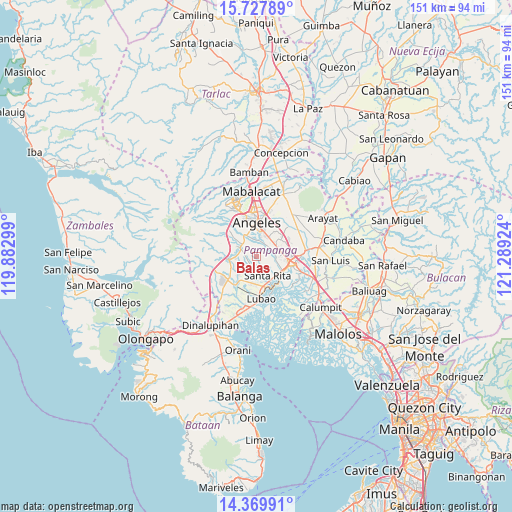
Balas GPS coordinates[2]
15° 2' 59.928" North, 120° 35' 9.996" East
| Map corner | latitude | longitude |
|---|---|---|
| Upper-left | 15.72789°, | 119.88299° |
| Center: | 15.04998°, | 120.58611° |
| Lower-right: | 14.36991°, | 121.28924° |
| Map W x H: | 151×151 km | = 93.8×93.8mi |
| max Lat: | 20.78733° ⇑21.8% North |
| Balas: | 15.04998° |
| min Lat: | ⇓78.2% South 4.65442° |
| min Long | Balas | max Long |
| 117.04868° | 120.58611° | 126.58417° |
| W 11.4%⇐ | ⇒88.6% E |
Elevation
Elevation of Balas is 47 m = 154 ft, and this is 40.9 m = 134 ft below average elevation for this country.
| Max E: |
2262 m = 7421 ft | 32.5% |
| Avg. | 87.9 m = 288 ft | |
| Balas | 47 m = 154 ft | |
Min E: |
-2 m = -7 ft | 67.5% |
See also: Philippines elevation on elevation.city.
Geographical zone
Balas is located in North Torrid zone (between Equator and Tropic of Cancer). Distance of this Northern Tropic circle is 932.5 km =579.4 mi to North.| Distance of | km | miles | from Balas |
|---|---|---|---|
| North Pole | 8333.7 | 5178.3 | to North |
| Arctic Circle | 5727.8 | 3559.1 | to North |
| Tropic Cancer | 932.5 | 579.4 | to North |
| Equator | 1673.4 | 1039.8 | to South |


Nearby cities:
15 places around Balas: (largest is in red/bold)
• Calantas
8.1 km =5 mi,  245°
245°
• Calibutbut
7.3 km =4.5 mi,  10°
10°
• Del Carmen
7.5 km =4.7 mi,  228°
228°
• Dolores
7.9 km =4.9 mi,  309°
309°
• Manibaug Pasig
5.6 km =3.5 mi,  335°
335°
• Maquiapo
7.7 km =4.8 mi,  202°
202°
• Pias
4.5 km =2.8 mi,  214°
214°
• Pio
7.2 km =4.5 mi,  267°
267°
• Porac
5.3 km =3.3 mi,  296°
296°
• Pulung Santol
2.6 km =1.6 mi,  259°
259°
• Pulungmasle
6.3 km =3.9 mi, 208°
• San Agustin
7 km =4.3 mi,  162°
162°
• San Basilio
1.9 km =1.2 mi,  186°
186°
• Santa Rita
6.3 km =3.9 mi,  154°
154°
• Telabastagan
8 km =5 mi,  16°
16°
Sources, notices
• [Note1] Compared only with cities in Philippines existing in our database
• [Src1] Map data: © OpenStreetMap contributors (CC-BY-SA)
• [Src2] Other city data from geonames.org with taken over terms of usage.
• [Src3] Geographical zone / Annual Mean Temperature by Robert A. Rohde @ Wikipedia
