Pawak geodata
Pawak (Autonomous Region in Muslim Mindanao) is a populated place; located in Philippines in Asia/Manila (GMT+8) time zone. With population of 2,555 people, there are 3201 cities with bigger population in this country. Compared to other cities in Philippines, 82.6% of cities are located further ↑North; 74.7% of cities are located further ←West and 97.1% of cities have lower elevation than Pawak. Note1
Administrative division(s):
- Level 1: Autonomous Region in Muslim Mindanao
- Level 2: Province of Lanao del Sur
- Level 3: Saguiaran


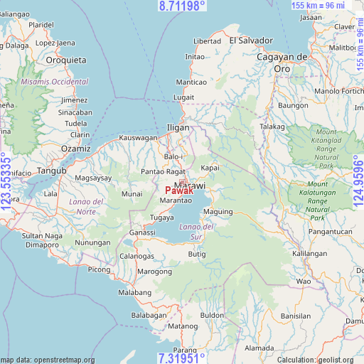
Pawak GPS coordinates[2]
8° 0' 58.824" North, 124° 15' 23.292" East
| Map corner | latitude | longitude |
|---|---|---|
| Upper-left | 8.71198°, | 123.55335° |
| Center: | 8.01634°, | 124.25647° |
| Lower-right: | 7.31951°, | 124.9596° |
| Map W x H: | 154.8×154.8 km | = 96.2×96.2mi |
| max Lat: | 20.78733° ⇑82.6% North |
| Pawak: | 8.01634° |
| min Lat: | ⇓17.4% South 4.65442° |
| min Long | Pawak | max Long |
| 117.04868° | 124.25647° | 126.58417° |
| W 74.7%⇐ | ⇒25.3% E |
Elevation
Elevation of Pawak is 623 m = 2044 ft, and this is 535.1 m = 1756 ft above average elevation for this country.
| Max E: |
2262 m = 7421 ft | 2.9% |
| Pawak | 623 m 2044 ft | |
| Avg. | 87.9 m = 288 ft | |
Min E: |
-2 m = -7 ft | 97.1% |
See also: Philippines elevation on elevation.city.
Geographical zone
Pawak is located in North Torrid zone (between Equator and Tropic of Cancer). Distance of Equator is 891.3 km =553.8 mi to South.| Distance of | km | miles | from Pawak |
|---|---|---|---|
| North Pole | 9115.7 | 5664.2 | to North |
| Arctic Circle | 6509.8 | 4045 | to North |
| Tropic Cancer | 1714.6 | 1065.4 | to North |
| Equator | 891.3 | 553.8 | to South |


Nearby cities:
15 places around Pawak: (largest is in red/bold)
• Balindong
12.7 km =7.9 mi,  209°
209°
• Buadiposo-Buntong
15 km =9.3 mi,  111°
111°
• Dimayon
13 km =8.1 mi,  295°
295°
• Ditsaan
11.2 km =7 mi, 111°
• Kalanganan
7.5 km =4.7 mi,  351°
351°
• Mamungan
12 km =7.5 mi,  339°
339°
• Marantao
7.8 km =4.8 mi,  199°
199°
• Marawi City
3.4 km =2.1 mi,  115°
115°
• Matungao
16.8 km =10.4 mi,  322°
322°
• Molundo
15.2 km =9.4 mi, 124°
• Pantao-Ragat
15.5 km =9.6 mi, 298°
• Pantar
5.5 km =3.4 mi,  2°
2°
• Poona-Piagapo
17.1 km =10.6 mi, 295°
• Ramain
11 km =6.8 mi, 117°
• Saguiaran
2.4 km =1.5 mi,  38°
38°
Sources, notices
• [Note1] Compared only with cities in Philippines existing in our database
• [Src1] Map data: © OpenStreetMap contributors (CC-BY-SA)
• [Src2] Other city data from geonames.org with taken over terms of usage.
• [Src3] Geographical zone / Annual Mean Temperature by Robert A. Rohde @ Wikipedia
