Parang geodata
Parang (Autonomous Region in Muslim Mindanao) is a populated place; located in Philippines in Asia/Manila (GMT+8) time zone. With population of 9,681 people, there are 634 cities with bigger population in this country. Compared to other cities in Philippines, 98.6% of cities are located further ↑North; 79.2% of cities are located further →East and 89.7% of cities have higher elevation than Parang. Note1
Administrative division(s):
- Level 1: Autonomous Region in Muslim Mindanao
- Level 2: Province of Sulu
- Level 3: Parang


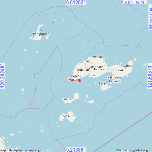
Parang GPS coordinates[2]
5° 54' 49.32" North, 120° 54' 20.16" East
| Map corner | latitude | longitude |
|---|---|---|
| Upper-left | 6.61262°, | 120.20248° |
| Center: | 5.9137°, | 120.9056° |
| Lower-right: | 5.21389°, | 121.60873° |
| Map W x H: | 155.5×155.5 km | = 96.6×96.6mi |
| max Lat: | 20.78733° ⇑98.6% North |
| Parang: | 5.9137° |
| min Lat: | ⇓1.4% South 4.65442° |
| min Long | Parang | max Long |
| 117.04868° | 120.9056° | 126.58417° |
| W 20.8%⇐ | ⇒79.2% E |
Elevation
Elevation of Parang is 7 m = 23 ft, and this is 80.9 m = 265 ft below average elevation for this country.
| Max E: |
2262 m = 7421 ft | 89.7% |
| Avg. | 87.9 m = 288 ft | |
| Parang | 7 m = 23 ft | |
Min E: |
-2 m = -7 ft | 10.3% |
See also: Philippines elevation on elevation.city.
Geographical zone
Parang is located in North Torrid zone (between Equator and Tropic of Cancer). Distance of Equator is 657.5 km =408.6 mi to South.| Distance of | km | miles | from Parang |
|---|---|---|---|
| North Pole | 9349.5 | 5809.5 | to North |
| Arctic Circle | 6743.6 | 4190.3 | to North |
| Tropic Cancer | 1948.4 | 1210.7 | to North |
| Equator | 657.5 | 408.6 | to South |


Nearby cities:
15 places around Parang: (largest is in red/bold)
• Anuling
17.6 km =10.9 mi,  39°
39°
• Bato Bato
14.2 km =8.8 mi,  18°
18°
• Baunu-Timbangan
14.1 km =8.8 mi, 43°
• Bawison
4.3 km =2.7 mi,  307°
307°
• Binuang
17.7 km =11 mi,  74°
74°
• Buansa
13.9 km =8.6 mi,  26°
26°
• Jolo
18.7 km =11.6 mi, 34°
• Kagay
10.6 km =6.6 mi,  1°
1°
• Kajatian
16.2 km =10.1 mi, 36°
• Kulase
5.8 km =3.6 mi,  99°
99°
• Langpas
8.3 km =5.2 mi, 35°
• Maimbung
13.4 km =8.3 mi,  80°
80°
• Panabuan
8.3 km =5.2 mi,  49°
49°
• Payuhan
3.1 km =1.9 mi,  350°
350°
• Sionogan
11.2 km =7 mi, 25°
Sources, notices
• [Note1] Compared only with cities in Philippines existing in our database
• [Src1] Map data: © OpenStreetMap contributors (CC-BY-SA)
• [Src2] Other city data from geonames.org with taken over terms of usage.
• [Src3] Geographical zone / Annual Mean Temperature by Robert A. Rohde @ Wikipedia
