Panabuan geodata
Panabuan (Autonomous Region in Muslim Mindanao) is a populated place; located in Philippines in Asia/Manila (GMT+8) time zone. With population of 2,528 people, there are 3246 cities with bigger population in this country. Compared to other cities in Philippines, 98.1% of cities are located further ↑North; 77.4% of cities are located further →East and 87.5% of cities have lower elevation than Panabuan. Note1
Administrative division(s):
- Level 1: Autonomous Region in Muslim Mindanao
- Level 2: Province of Sulu
- Level 3: Indanan


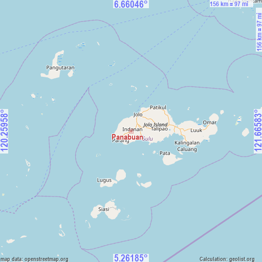
Panabuan GPS coordinates[2]
5° 57' 41.76" North, 120° 57' 45.72" East
| Map corner | latitude | longitude |
|---|---|---|
| Upper-left | 6.66046°, | 120.25958° |
| Center: | 5.9616°, | 120.9627° |
| Lower-right: | 5.26185°, | 121.66583° |
| Map W x H: | 155.5×155.5 km | = 96.6×96.6mi |
| max Lat: | 20.78733° ⇑98.1% North |
| Panabuan: | 5.9616° |
| min Lat: | ⇓1.9% South 4.65442° |
| min Long | Panabuan | max Long |
| 117.04868° | 120.9627° | 126.58417° |
| W 22.6%⇐ | ⇒77.4% E |
Elevation
Elevation of Panabuan is 174 m = 571 ft, and this is 86.1 m = 282 ft above average elevation for this country.
| Max E: |
2262 m = 7421 ft | 12.5% |
| Panabuan | 174 m 571 ft | |
| Avg. | 87.9 m = 288 ft | |
Min E: |
-2 m = -7 ft | 87.5% |
See also: Philippines elevation on elevation.city.
Geographical zone
Panabuan is located in North Torrid zone (between Equator and Tropic of Cancer). Distance of Equator is 662.9 km =411.9 mi to South.| Distance of | km | miles | from Panabuan |
|---|---|---|---|
| North Pole | 9344.2 | 5806.2 | to North |
| Arctic Circle | 6738.3 | 4187 | to North |
| Tropic Cancer | 1943.1 | 1207.4 | to North |
| Equator | 662.9 | 411.9 | to South |


Nearby cities:
15 places around Panabuan: (largest is in red/bold)
• Anuling
9.6 km =6 mi,  30°
30°
• Bato Bato
8.3 km =5.2 mi,  347°
347°
• Baunu-Timbangan
6 km =3.7 mi,  35°
35°
• Bawison
10.1 km =6.3 mi,  254°
254°
• Binuang
10.8 km =6.7 mi,  92°
92°
• Buansa
7.1 km =4.4 mi,  358°
358°
• Jolo
11 km =6.8 mi,  23°
23°
• Kagay
8.1 km =5 mi,  310°
310°
• Kajatian
8.4 km =5.2 mi, 22°
• Kulase
6.3 km =3.9 mi,  185°
185°
• Langpas
2.1 km =1.3 mi, 314°
• Maimbung
7.6 km =4.7 mi,  114°
114°
• Parang
8.3 km =5.2 mi,  229°
229°
• Payuhan
7.2 km =4.5 mi, 251°
• Sionogan
5.1 km =3.2 mi,  342°
342°
Sources, notices
• [Note1] Compared only with cities in Philippines existing in our database
• [Src1] Map data: © OpenStreetMap contributors (CC-BY-SA)
• [Src2] Other city data from geonames.org with taken over terms of usage.
• [Src3] Geographical zone / Annual Mean Temperature by Robert A. Rohde @ Wikipedia
