Bawison geodata
Bawison (Autonomous Region in Muslim Mindanao) is a populated place; located in Philippines in Asia/Manila (GMT+8) time zone. With population of 3,461 people, there are 2095 cities with bigger population in this country. Compared to other cities in Philippines, 98.4% of cities are located further ↑North; 80.2% of cities are located further →East and 76.6% of cities have higher elevation than Bawison. Note1
Administrative division(s):
- Level 1: Autonomous Region in Muslim Mindanao
- Level 2: Province of Sulu
- Level 3: Parang


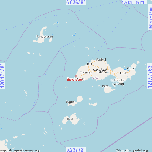
Bawison GPS coordinates[2]
5° 56' 15" North, 120° 52' 28.2" East
| Map corner | latitude | longitude |
|---|---|---|
| Upper-left | 6.63639°, | 120.17138° |
| Center: | 5.9375°, | 120.8745° |
| Lower-right: | 5.23772°, | 121.57763° |
| Map W x H: | 155.5×155.5 km | = 96.6×96.6mi |
| max Lat: | 20.78733° ⇑98.4% North |
| Bawison: | 5.9375° |
| min Lat: | ⇓1.6% South 4.65442° |
| min Long | Bawison | max Long |
| 117.04868° | 120.8745° | 126.58417° |
| W 19.8%⇐ | ⇒80.2% E |
Elevation
Elevation of Bawison is 10 m = 33 ft, and this is 77.9 m = 256 ft below average elevation for this country.
| Max E: |
2262 m = 7421 ft | 76.6% |
| Avg. | 87.9 m = 288 ft | |
| Bawison | 10 m = 33 ft | |
Min E: |
-2 m = -7 ft | 23.4% |
See also: Philippines elevation on elevation.city.
Geographical zone
Bawison is located in North Torrid zone (between Equator and Tropic of Cancer). Distance of Equator is 660.2 km =410.2 mi to South.| Distance of | km | miles | from Bawison |
|---|---|---|---|
| North Pole | 9346.9 | 5807.9 | to North |
| Arctic Circle | 6741 | 4188.7 | to North |
| Tropic Cancer | 1945.7 | 1209 | to North |
| Equator | 660.2 | 410.2 | to South |


Nearby cities:
15 places around Bawison: (largest is in red/bold)
• Anuling
18.2 km =11.3 mi,  53°
53°
• Bato Bato
13.4 km =8.3 mi,  36°
36°
• Baunu-Timbangan
15.2 km =9.4 mi,  60°
60°
• Binuang
20.6 km =12.8 mi,  83°
83°
• Buansa
13.7 km =8.5 mi, 44°
• Jolo
19 km =11.8 mi, 47°
• Kagay
8.7 km =5.4 mi,  24°
24°
• Kajatian
16.6 km =10.3 mi, 51°
• Kulase
9.8 km =6.1 mi,  111°
111°
• Langpas
9.2 km =5.7 mi, 63°
• Maimbung
16.6 km =10.3 mi,  91°
91°
• Panabuan
10.1 km =6.3 mi,  74°
74°
• Parang
4.3 km =2.7 mi,  127°
127°
• Payuhan
3 km =1.9 mi, 81°
• Sionogan
11.1 km =6.9 mi, 47°
Sources, notices
• [Note1] Compared only with cities in Philippines existing in our database
• [Src1] Map data: © OpenStreetMap contributors (CC-BY-SA)
• [Src2] Other city data from geonames.org with taken over terms of usage.
• [Src3] Geographical zone / Annual Mean Temperature by Robert A. Rohde @ Wikipedia
