Palusapis geodata
Palusapis (Central Luzon) is a populated place; located in Philippines in Asia/Manila (GMT+8) time zone. With population of 2,443 people, there are 3394 cities with bigger population in this country. Compared to other cities in Philippines, 83.8% of cities are located further ↓South; 80.6% of cities are located further →East and 70.5% of cities have lower elevation than Palusapis. Note1
Administrative division(s):
- Level 1: Central Luzon
- Level 2: Province of Nueva Ecija
- Level 3: Science City of Muñoz


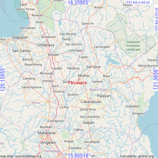
Palusapis GPS coordinates[2]
15° 40' 59.664" North, 120° 51' 45.612" East
| Map corner | latitude | longitude |
|---|---|---|
| Upper-left | 16.35905°, | 120.15955° |
| Center: | 15.68324°, | 120.86267° |
| Lower-right: | 15.00518°, | 121.5658° |
| Map W x H: | 150.5×150.5 km | = 93.5×93.5mi |
| max Lat: | 20.78733° ⇑16.2% North |
| Palusapis: | 15.68324° |
| min Lat: | ⇓83.8% South 4.65442° |
| min Long | Palusapis | max Long |
| 117.04868° | 120.86267° | 126.58417° |
| W 19.4%⇐ | ⇒80.6% E |
Elevation
Elevation of Palusapis is 53 m = 174 ft, and this is 34.9 m = 115 ft below average elevation for this country.
| Max E: |
2262 m = 7421 ft | 29.5% |
| Avg. | 87.9 m = 288 ft | |
| Palusapis | 53 m = 174 ft | |
Min E: |
-2 m = -7 ft | 70.5% |
See also: Philippines elevation on elevation.city.
Geographical zone
Palusapis is located in North Torrid zone (between Equator and Tropic of Cancer). Distance of this Northern Tropic circle is 862.1 km =535.7 mi to North.| Distance of | km | miles | from Palusapis |
|---|---|---|---|
| North Pole | 8263.2 | 5134.5 | to North |
| Arctic Circle | 5657.4 | 3515.3 | to North |
| Tropic Cancer | 862.1 | 535.7 | to North |
| Equator | 1743.8 | 1083.5 | to South |


Nearby cities:
15 places around Palusapis: (largest is in red/bold)
• Baloc
5 km =3.1 mi,  151°
151°
• Bunol
3.5 km =2.2 mi,  239°
239°
• Cavite
10 km =6.2 mi,  266°
266°
• Cawayan Bugtong
10.7 km =6.6 mi, 238°
• Guimba
10.4 km =6.5 mi,  255°
255°
• Magtangol
10.1 km =6.3 mi,  34°
34°
• Maligaya
2.9 km =1.8 mi,  108°
108°
• Maturanoc
8.1 km =5 mi,  248°
248°
• Muñoz
5.7 km =3.5 mi,  49°
49°
• San Andres
10 km =6.2 mi,  293°
293°
• San Fabian
10.8 km =6.7 mi, 154°
• Santa Rita
7.2 km =4.5 mi,  174°
174°
• Santo Rosario
4.3 km =2.7 mi,  182°
182°
• Tabacao
9.1 km =5.7 mi, 114°
• Villa Isla
9.7 km =6 mi,  2°
2°
Sources, notices
• [Note1] Compared only with cities in Philippines existing in our database
• [Src1] Map data: © OpenStreetMap contributors (CC-BY-SA)
• [Src2] Other city data from geonames.org with taken over terms of usage.
• [Src3] Geographical zone / Annual Mean Temperature by Robert A. Rohde @ Wikipedia
