Villa Isla geodata
Villa Isla (Central Luzon) is a populated place; located in Philippines in Asia/Manila (GMT+8) time zone. With population of 2,256 people, there are 3774 cities with bigger population in this country. Compared to other cities in Philippines, 84.6% of cities are located further ↓South; 80.5% of cities are located further →East and 80.1% of cities have lower elevation than Villa Isla. Note1
Administrative division(s):
- Level 1: Central Luzon
- Level 2: Province of Nueva Ecija
- Level 3: Science City of Muñoz


Villa Isla GPS coordinates[2]
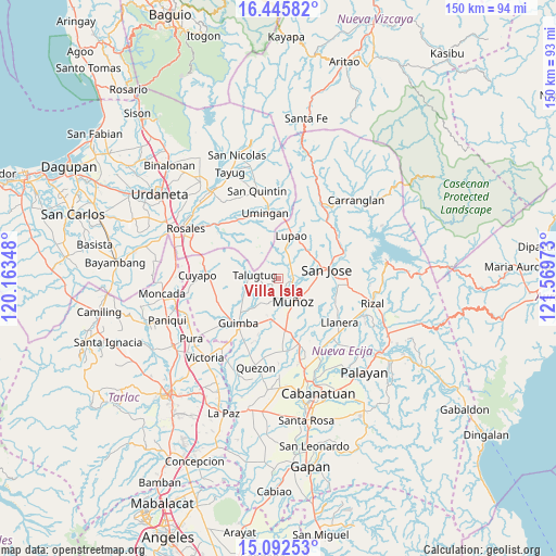
15° 46' 13.08" North, 120° 51' 59.76" East
| Map corner | latitude | longitude |
|---|---|---|
| Upper-left | 16.44582°, | 120.16348° |
| Center: | 15.7703°, | 120.8666° |
| Lower-right: | 15.09253°, | 121.56973° |
| Map W x H: | 150.5×150.5 km | = 93.5×93.5mi |
| max Lat: | 20.78733° ⇑15.4% North |
| Villa Isla: | 15.7703° |
| min Lat: | ⇓84.6% South 4.65442° |
| min Long | Villa Isla | max Long |
| 117.04868° | 120.8666° | 126.58417° |
| W 19.5%⇐ | ⇒80.5% E |
Elevation
Elevation of Villa Isla is 93 m = 305 ft, and this is 5.1 m = 17 ft above average elevation for this country.
| Max E: |
2262 m = 7421 ft | 19.9% |
| Villa Isla | 93 m 305 ft | |
| Avg. | 87.9 m = 288 ft | |
Min E: |
-2 m = -7 ft | 80.1% |
See also: Philippines elevation on elevation.city.
Geographical zone
Villa Isla is located in North Torrid zone (between Equator and Tropic of Cancer). Distance of this Northern Tropic circle is 852.4 km =529.7 mi to North.| Distance of | km | miles | from Villa Isla |
|---|---|---|---|
| North Pole | 8253.6 | 5128.5 | to North |
| Arctic Circle | 5647.7 | 3509.3 | to North |
| Tropic Cancer | 852.4 | 529.7 | to North |
| Equator | 1753.5 | 1089.6 | to South |


Nearby cities:
15 places around Villa Isla: (largest is in red/bold)
• Baloy
10.6 km =6.6 mi,  291°
291°
• Bunol
12 km =7.5 mi,  196°
196°
• Diaz
9.1 km =5.7 mi,  338°
338°
• Lupao
12.6 km =7.8 mi,  15°
15°
• Magtangol
5.4 km =3.4 mi,  104°
104°
• Maligaya
10.9 km =6.8 mi,  167°
167°
• Muñoz
7.2 km =4.5 mi,  147°
147°
• Palusapis
9.7 km =6 mi,  182°
182°
• Parista
11.4 km =7.1 mi,  35°
35°
• Salvacion I
9.3 km =5.8 mi,  34°
34°
• Sampaloc
5.2 km =3.2 mi,  0°
0°
• San Andres
11.1 km =6.9 mi,  239°
239°
• Santo Tomas
10.5 km =6.5 mi, 102°
• Talugtug
6 km =3.7 mi,  277°
277°
• Tondod
12.3 km =7.6 mi,  118°
118°
Sources, notices
• [Note1] Compared only with cities in Philippines existing in our database
• [Src1] Map data: © OpenStreetMap contributors (CC-BY-SA)
• [Src2] Other city data from geonames.org with taken over terms of usage.
• [Src3] Geographical zone / Annual Mean Temperature by Robert A. Rohde @ Wikipedia
