Marawis geodata
Marawis (Western Visayas) is a populated place; located in Philippines in Asia/Manila (GMT+8) time zone. With population of 2,233 people, there are 3815 cities with bigger population in this country. Compared to other cities in Philippines, 65.8% of cities are located further ↑North; 51.4% of cities are located further ←West and 59.2% of cities have higher elevation than Marawis. Note1
Administrative division(s):
- Level 1: Western Visayas
- Level 2: Province of Negros Occidental
- Level 3: Hinigaran


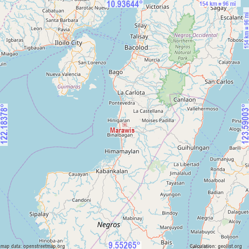
Marawis GPS coordinates[2]
10° 14' 43.08" North, 122° 53' 12.84" East
| Map corner | latitude | longitude |
|---|---|---|
| Upper-left | 10.93644°, | 122.18378° |
| Center: | 10.2453°, | 122.8869° |
| Lower-right: | 9.55265°, | 123.59003° |
| Map W x H: | 153.9×153.9 km | = 95.6×95.6mi |
| max Lat: | 20.78733° ⇑65.8% North |
| Marawis: | 10.2453° |
| min Lat: | ⇓34.2% South 4.65442° |
| min Long | Marawis | max Long |
| 117.04868° | 122.8869° | 126.58417° |
| W 51.4%⇐ | ⇒48.6% E |
Elevation
Elevation of Marawis is 17 m = 56 ft, and this is 70.9 m = 233 ft below average elevation for this country.
| Max E: |
2262 m = 7421 ft | 59.2% |
| Avg. | 87.9 m = 288 ft | |
| Marawis | 17 m = 56 ft | |
Min E: |
-2 m = -7 ft | 40.8% |
See also: Philippines elevation on elevation.city.
Geographical zone
Marawis is located in North Torrid zone (between Equator and Tropic of Cancer). Distance of Equator is 1139.2 km =707.9 mi to South.| Distance of | km | miles | from Marawis |
|---|---|---|---|
| North Pole | 8867.9 | 5510.3 | to North |
| Arctic Circle | 6262 | 3891 | to North |
| Tropic Cancer | 1466.7 | 911.4 | to North |
| Equator | 1139.2 | 707.9 | to South |


Nearby cities:
15 places around Marawis: (largest is in red/bold)
• Aguisan
9.9 km =6.2 mi,  196°
196°
• Aranda
6.6 km =4.1 mi,  98°
98°
• Bagroy
7.1 km =4.4 mi,  131°
131°
• Binalbagan
6.4 km =4 mi,  209°
209°
• Calape
10.1 km =6.3 mi,  71°
71°
• Camalobalo
7.6 km =4.7 mi, 66°
• Guintubhan
9.3 km =5.8 mi,  116°
116°
• Hinigaran
4.9 km =3 mi,  305°
305°
• Isabela
12 km =7.5 mi,  111°
111°
• Libacao
7.8 km =4.8 mi,  158°
158°
• Miranda
6.7 km =4.2 mi,  351°
351°
• Montilla
6.4 km =4 mi,  137°
137°
• Nato
11 km =6.8 mi,  194°
194°
• Patique
1.6 km =1 mi, 124°
• Payao
8.4 km =5.2 mi,  151°
151°
Sources, notices
• [Note1] Compared only with cities in Philippines existing in our database
• [Src1] Map data: © OpenStreetMap contributors (CC-BY-SA)
• [Src2] Other city data from geonames.org with taken over terms of usage.
• [Src3] Geographical zone / Annual Mean Temperature by Robert A. Rohde @ Wikipedia
