Muricay geodata
Muricay (Zamboanga Peninsula) is a populated place; located in Philippines in Asia/Manila (GMT+8) time zone. With population of 132,094 people, there are 73 cities with bigger population in this country. Compared to other cities in Philippines, 84% of cities are located further ↑North; 61.7% of cities are located further ←West and 98.1% of cities have higher elevation than Muricay. Note1
Administrative division(s):
- Level 1: Zamboanga Peninsula
- Level 2: Province of Zamboanga del Sur
- Level 3: Pagadian City


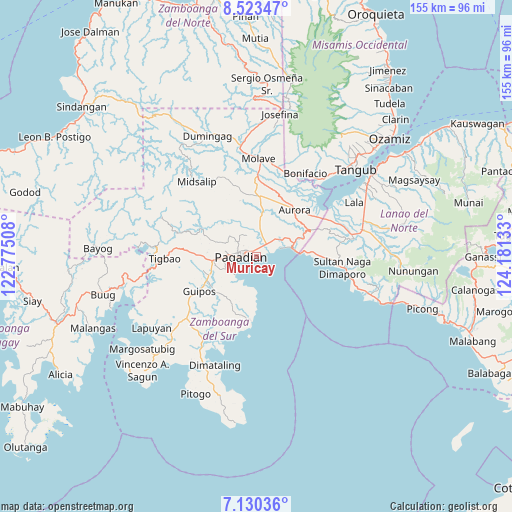
Muricay GPS coordinates[2]
7° 49' 39" North, 123° 28' 41.52" East
| Map corner | latitude | longitude |
|---|---|---|
| Upper-left | 8.52347°, | 122.77508° |
| Center: | 7.8275°, | 123.4782° |
| Lower-right: | 7.13036°, | 124.18133° |
| Map W x H: | 154.9×154.9 km | = 96.3×96.3mi |
| max Lat: | 20.78733° ⇑84% North |
| Muricay: | 7.8275° |
| min Lat: | ⇓16% South 4.65442° |
| min Long | Muricay | max Long |
| 117.04868° | 123.4782° | 126.58417° |
| W 61.7%⇐ | ⇒38.3% E |
Elevation
Elevation of Muricay is 3 m = 10 ft, and this is 84.9 m = 279 ft below average elevation for this country.
| Max E: |
2262 m = 7421 ft | 98.1% |
| Avg. | 87.9 m = 288 ft | |
| Muricay | 3 m = 10 ft | |
Min E: |
-2 m = -7 ft | 1.9% |
See also: Muricay elevation on elevation.city.
Geographical zone
Muricay is located in North Torrid zone (between Equator and Tropic of Cancer). Distance of Equator is 870.3 km =540.8 mi to South.| Distance of | km | miles | from Muricay |
|---|---|---|---|
| North Pole | 9136.7 | 5677.3 | to North |
| Arctic Circle | 6530.8 | 4058 | to North |
| Tropic Cancer | 1735.6 | 1078.5 | to North |
| Equator | 870.3 | 540.8 | to South |


Nearby cities:
15 places around Muricay: (largest is in red/bold)
• Aurora
17.9 km =11.1 mi,  40°
40°
• Danlugan
13.6 km =8.5 mi,  301°
301°
• Dumalinao
12 km =7.5 mi,  265°
265°
• Gubaan
18.9 km =11.7 mi,  29°
29°
• Guiniculalay
21.3 km =13.2 mi,  206°
206°
• Guipos
21.2 km =13.2 mi,  234°
234°
• Kagawasan
10.1 km =6.3 mi, 295°
• Labangan
5.6 km =3.5 mi, 41°
• Pagadian
4.5 km =2.8 mi, 267°
• Ramon Magsaysay
19.7 km =12.2 mi,  10°
10°
• Robonkon
10.5 km =6.5 mi,  218°
218°
• San Pablo
19.1 km =11.9 mi,  185°
185°
• Taguitic
20.9 km =13 mi,  53°
53°
• Tawagan
2 km =1.2 mi,  350°
350°
• Tucuran
10.9 km =6.8 mi,  75°
75°
Sources, notices
• [Note1] Compared only with cities in Philippines existing in our database
• [Src1] Map data: © OpenStreetMap contributors (CC-BY-SA)
• [Src2] Other city data from geonames.org with taken over terms of usage.
• [Src3] Geographical zone / Annual Mean Temperature by Robert A. Rohde @ Wikipedia
