Robonkon geodata
Robonkon (Zamboanga Peninsula) is a populated place; located in Philippines in Asia/Manila (GMT+8) time zone. With population of 2,494 people, there are 3303 cities with bigger population in this country. Compared to other cities in Philippines, 84.7% of cities are located further ↑North; 60.7% of cities are located further ←West and 92.7% of cities have higher elevation than Robonkon. Note1
Administrative division(s):
- Level 1: Zamboanga Peninsula
- Level 2: Province of Zamboanga del Sur
- Level 3: Dumalinao


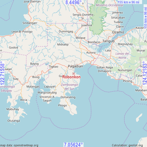
Robonkon GPS coordinates[2]
7° 45' 12.6" North, 123° 25' 7.32" East
| Map corner | latitude | longitude |
|---|---|---|
| Upper-left | 8.4496°, | 122.71558° |
| Center: | 7.7535°, | 123.4187° |
| Lower-right: | 7.05624°, | 124.12183° |
| Map W x H: | 154.9×154.9 km | = 96.3×96.3mi |
| max Lat: | 20.78733° ⇑84.7% North |
| Robonkon: | 7.7535° |
| min Lat: | ⇓15.3% South 4.65442° |
| min Long | Robonkon | max Long |
| 117.04868° | 123.4187° | 126.58417° |
| W 60.7%⇐ | ⇒39.3% E |
Elevation
Elevation of Robonkon is 6 m = 20 ft, and this is 81.9 m = 269 ft below average elevation for this country.
| Max E: |
2262 m = 7421 ft | 92.7% |
| Avg. | 87.9 m = 288 ft | |
| Robonkon | 6 m = 20 ft | |
Min E: |
-2 m = -7 ft | 7.3% |
See also: Philippines elevation on elevation.city.
Geographical zone
Robonkon is located in North Torrid zone (between Equator and Tropic of Cancer). Distance of Equator is 862.1 km =535.7 mi to South.| Distance of | km | miles | from Robonkon |
|---|---|---|---|
| North Pole | 9145 | 5682.4 | to North |
| Arctic Circle | 6539.1 | 4063.2 | to North |
| Tropic Cancer | 1743.8 | 1083.5 | to North |
| Equator | 862.1 | 535.7 | to South |


Nearby cities:
15 places around Robonkon: (largest is in red/bold)
• Binuatan
17.7 km =11 mi,  207°
207°
• Danlugan
16.1 km =10 mi,  341°
341°
• Dumalinao
9.1 km =5.7 mi,  323°
323°
• East Migpulao
15 km =9.3 mi, 205°
• Guiniculalay
11.2 km =7 mi,  195°
195°
• Guipos
11.4 km =7.1 mi,  248°
248°
• Kagawasan
12.8 km =8 mi,  348°
348°
• Labangan
16.2 km =10.1 mi,  39°
39°
• Legrada
18.4 km =11.4 mi,  223°
223°
• Muricay
10.5 km =6.5 mi, 38°
• Pagadian
8.3 km =5.2 mi,  14°
14°
• Sagacad
11.4 km =7.1 mi,  228°
228°
• San Pablo
11.8 km =7.3 mi,  156°
156°
• Tawagan
11.9 km =7.4 mi,  31°
31°
• Tucuran
20.4 km =12.7 mi,  57°
57°
Sources, notices
• [Note1] Compared only with cities in Philippines existing in our database
• [Src1] Map data: © OpenStreetMap contributors (CC-BY-SA)
• [Src2] Other city data from geonames.org with taken over terms of usage.
• [Src3] Geographical zone / Annual Mean Temperature by Robert A. Rohde @ Wikipedia
