Mayorga geodata
Mayorga (Eastern Visayas) is a seat of a third-order administrative division; located in Philippines in Asia/Manila (GMT+8) time zone. With population of 2,721 people, there are 2908 cities with bigger population in this country. Compared to other cities in Philippines, 58.1% of cities are located further ↑North; 87.5% of cities are located further ←West and 95.5% of cities have higher elevation than Mayorga. Note1


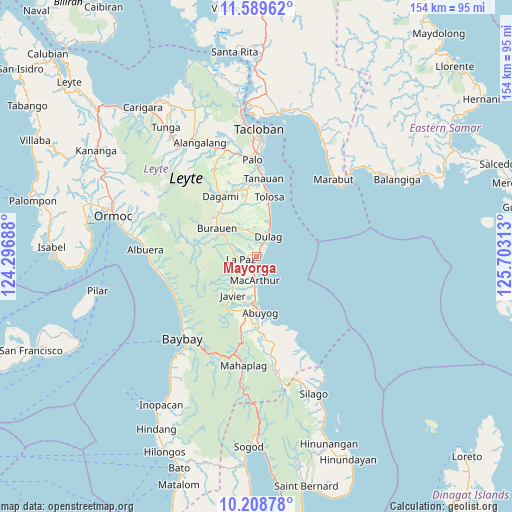
Mayorga GPS coordinates[2]
10° 54' 0" North, 125° 0' 0" East
| Map corner | latitude | longitude |
|---|---|---|
| Upper-left | 11.58962°, | 124.29688° |
| Center: | 10.9°, | 125° |
| Lower-right: | 10.20878°, | 125.70313° |
| Map W x H: | 153.5×153.5 km | = 95.4×95.4mi |
| max Lat: | 20.78733° ⇑58.1% North |
| Mayorga: | 10.9° |
| min Lat: | ⇓41.9% South 4.65442° |
| min Long | Mayorga | max Long |
| 117.04868° | 125° | 126.58417° |
| W 87.5%⇐ | ⇒12.5% E |
Elevation
Elevation of Mayorga is 5 m = 16 ft, and this is 82.9 m = 272 ft below average elevation for this country.
| Max E: |
2262 m = 7421 ft | 95.5% |
| Avg. | 87.9 m = 288 ft | |
| Mayorga | 5 m = 16 ft | |
Min E: |
-2 m = -7 ft | 4.5% |
See also: Philippines elevation on elevation.city.
Geographical zone
Mayorga is located in North Torrid zone (between Equator and Tropic of Cancer). Distance of Equator is 1212 km =753.1 mi to South.| Distance of | km | miles | from Mayorga |
|---|---|---|---|
| North Pole | 8795.1 | 5465 | to North |
| Arctic Circle | 6189.2 | 3845.8 | to North |
| Tropic Cancer | 1394 | 866.2 | to North |
| Equator | 1212 | 753.1 | to South |


Nearby cities:
15 places around Mayorga: (largest is in red/bold)
• Abuyog
17.1 km =10.6 mi,  176°
176°
• Balocawehay
20.1 km =12.5 mi,  190°
190°
• Bislig
19.5 km =12.1 mi,  10°
10°
• Bugho
13.9 km =8.6 mi,  210°
210°
• Burauen
14.4 km =8.9 mi,  305°
305°
• Cabacuñgan
4.2 km =2.6 mi,  331°
331°
• Dulag
6.8 km =4.2 mi,  30°
30°
• Julita
9.3 km =5.8 mi, 333°
• Kabuynan
20.3 km =12.6 mi, 7°
• La Paz
4.9 km =3 mi,  260°
260°
• Liberty
2.9 km =1.8 mi,  174°
174°
• MacArthur
7.3 km =4.5 mi, 184°
• San Jose
10.6 km =6.6 mi,  21°
21°
• San Roque
16.8 km =10.4 mi, 6°
• Tabontabon
16.2 km =10.1 mi,  344°
344°
Sources, notices
• [Note1] Compared only with cities in Philippines existing in our database
• [Src1] Map data: © OpenStreetMap contributors (CC-BY-SA)
• [Src2] Other city data from geonames.org with taken over terms of usage.
• [Src3] Geographical zone / Annual Mean Temperature by Robert A. Rohde @ Wikipedia
