Matnog geodata
Matnog (Bicol) is a seat of a third-order administrative division; located in Philippines in Asia/Manila (GMT+8) time zone. With population of 6,721 people, there are 933 cities with bigger population in this country. Compared to other cities in Philippines, 55.5% of cities are located further ↓South; 72.6% of cities are located further ←West and 95.5% of cities have higher elevation than Matnog. Note1


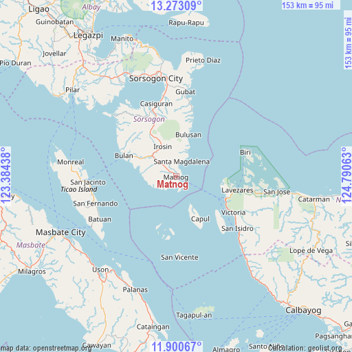
Matnog GPS coordinates[2]
12° 35' 16.08" North, 124° 5' 15" East
| Map corner | latitude | longitude |
|---|---|---|
| Upper-left | 13.27309°, | 123.38438° |
| Center: | 12.5878°, | 124.0875° |
| Lower-right: | 11.90067°, | 124.79063° |
| Map W x H: | 152.6×152.6 km | = 94.8×94.8mi |
| max Lat: | 20.78733° ⇑44.5% North |
| Matnog: | 12.5878° |
| min Lat: | ⇓55.5% South 4.65442° |
| min Long | Matnog | max Long |
| 117.04868° | 124.0875° | 126.58417° |
| W 72.6%⇐ | ⇒27.4% E |
Elevation
Elevation of Matnog is 5 m = 16 ft, and this is 82.9 m = 272 ft below average elevation for this country.
| Max E: |
2262 m = 7421 ft | 95.5% |
| Avg. | 87.9 m = 288 ft | |
| Matnog | 5 m = 16 ft | |
Min E: |
-2 m = -7 ft | 4.5% |
See also: Philippines elevation on elevation.city.
Geographical zone
Matnog is located in North Torrid zone (between Equator and Tropic of Cancer). Distance of this Northern Tropic circle is 1206.3 km =749.6 mi to North.| Distance of | km | miles | from Matnog |
|---|---|---|---|
| North Pole | 8607.4 | 5348.4 | to North |
| Arctic Circle | 6001.5 | 3729.2 | to North |
| Tropic Cancer | 1206.3 | 749.6 | to North |
| Equator | 1399.6 | 869.7 | to South |


Nearby cities:
15 places around Matnog: (largest is in red/bold)
• Allen
23.5 km =14.6 mi,  114°
114°
• Bulan
24.9 km =15.5 mi,  291°
291°
• Bulusan
18.3 km =11.4 mi,  11°
11°
• Butag
17.3 km =10.7 mi, 285°
• Capul
20.9 km =13 mi,  150°
150°
• Gabao
19.5 km =12.1 mi,  322°
322°
• Guruyan
23.3 km =14.5 mi, 316°
• Irosin
13.9 km =8.6 mi,  334°
334°
• Jubasan
24.5 km =15.2 mi,  117°
117°
• Monbon
17.5 km =10.9 mi, 334°
• Quezon
15 km =9.3 mi,  275°
275°
• Sabang
23.3 km =14.5 mi,  314°
314°
• San Roque
16.8 km =10.4 mi,  358°
358°
• Santa Magdalena
7.1 km =4.4 mi,  19°
19°
• Utabi
20.3 km =12.6 mi, 287°
Sources, notices
• [Note1] Compared only with cities in Philippines existing in our database
• [Src1] Map data: © OpenStreetMap contributors (CC-BY-SA)
• [Src2] Other city data from geonames.org with taken over terms of usage.
• [Src3] Geographical zone / Annual Mean Temperature by Robert A. Rohde @ Wikipedia
