Amucao geodata
Amucao (Central Luzon) is a populated place; located in Philippines in Asia/Manila (GMT+8) time zone. With population of 2,478 people, there are 3332 cities with bigger population in this country. Compared to other cities in Philippines, 81.4% of cities are located further ↓South; 85.3% of cities are located further →East and 54.4% of cities have lower elevation than Amucao. Note1
Administrative division(s):
- Level 1: Central Luzon
- Level 2: Province of Tarlac
- Level 3: City of Tarlac


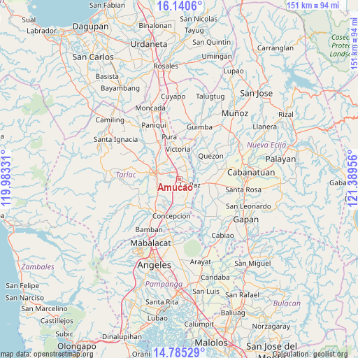
Amucao GPS coordinates[2]
15° 27' 50.58" North, 120° 41' 11.148" East
| Map corner | latitude | longitude |
|---|---|---|
| Upper-left | 16.1406°, | 119.98331° |
| Center: | 15.46405°, | 120.68643° |
| Lower-right: | 14.78529°, | 121.38956° |
| Map W x H: | 150.7×150.7 km | = 93.6×93.6mi |
| max Lat: | 20.78733° ⇑18.6% North |
| Amucao: | 15.46405° |
| min Lat: | ⇓81.4% South 4.65442° |
| min Long | Amucao | max Long |
| 117.04868° | 120.68643° | 126.58417° |
| W 14.7%⇐ | ⇒85.3% E |
Elevation
Elevation of Amucao is 27 m = 89 ft, and this is 60.9 m = 200 ft below average elevation for this country.
| Max E: |
2262 m = 7421 ft | 45.6% |
| Avg. | 87.9 m = 288 ft | |
| Amucao | 27 m = 89 ft | |
Min E: |
-2 m = -7 ft | 54.4% |
See also: Philippines elevation on elevation.city.
Geographical zone
Amucao is located in North Torrid zone (between Equator and Tropic of Cancer). Distance of this Northern Tropic circle is 886.5 km =550.8 mi to North.| Distance of | km | miles | from Amucao |
|---|---|---|---|
| North Pole | 8287.6 | 5149.7 | to North |
| Arctic Circle | 5681.7 | 3530.4 | to North |
| Tropic Cancer | 886.5 | 550.8 | to North |
| Equator | 1719.4 | 1068.4 | to South |


Nearby cities:
15 places around Amucao: (largest is in red/bold)
• Balingcanaway
2 km =1.2 mi,  356°
356°
• Bundoc
4.1 km =2.5 mi,  54°
54°
• Comillas
7.5 km =4.7 mi,  168°
168°
• Dumarais
3.3 km =2.1 mi, 169°
• La Paz
5.2 km =3.2 mi,  119°
119°
• Lomboy
4.6 km =2.9 mi, 46°
• Mabilog
8 km =5 mi,  196°
196°
• Mapalacsiao
5.4 km =3.4 mi,  222°
222°
• Matayumtayum
6.4 km =4 mi,  23°
23°
• Motrico
5.7 km =3.5 mi,  190°
190°
• Pando
7.8 km =4.8 mi,  181°
181°
• San Isidro
4.8 km =3 mi, 119°
• San Jacinto
9.2 km =5.7 mi,  348°
348°
• San Manuel
3.7 km =2.3 mi,  322°
322°
• San Pascual
4.6 km =2.9 mi,  333°
333°
Sources, notices
• [Note1] Compared only with cities in Philippines existing in our database
• [Src1] Map data: © OpenStreetMap contributors (CC-BY-SA)
• [Src2] Other city data from geonames.org with taken over terms of usage.
• [Src3] Geographical zone / Annual Mean Temperature by Robert A. Rohde @ Wikipedia
