Dumarais geodata
Dumarais (Central Luzon) is a populated place; located in Philippines in Asia/Manila (GMT+8) time zone. With population of 3,587 people, there are 1992 cities with bigger population in this country. Compared to other cities in Philippines, 81% of cities are located further ↓South; 85.2% of cities are located further →East and 56.6% of cities have lower elevation than Dumarais. Note1


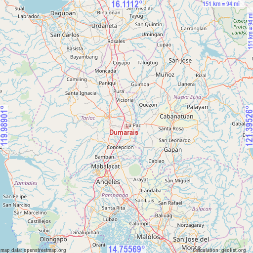
Dumarais GPS coordinates[2]
15° 26' 4.38" North, 120° 41' 31.668" East
| Map corner | latitude | longitude |
|---|---|---|
| Upper-left | 16.1112°, | 119.98901° |
| Center: | 15.43455°, | 120.69213° |
| Lower-right: | 14.75569°, | 121.39526° |
| Map W x H: | 150.7×150.7 km | = 93.6×93.6mi |
| max Lat: | 20.78733° ⇑19% North |
| Dumarais: | 15.43455° |
| min Lat: | ⇓81% South 4.65442° |
| min Long | Dumarais | max Long |
| 117.04868° | 120.69213° | 126.58417° |
| W 14.8%⇐ | ⇒85.2% E |
Elevation
Elevation of Dumarais is 29 m = 95 ft, and this is 58.9 m = 193 ft below average elevation for this country.
| Max E: |
2262 m = 7421 ft | 43.4% |
| Avg. | 87.9 m = 288 ft | |
| Dumarais | 29 m = 95 ft | |
Min E: |
-2 m = -7 ft | 56.6% |
See also: Philippines elevation on elevation.city.
Geographical zone
Dumarais is located in North Torrid zone (between Equator and Tropic of Cancer). Distance of this Northern Tropic circle is 889.8 km =552.9 mi to North.| Distance of | km | miles | from Dumarais |
|---|---|---|---|
| North Pole | 8290.9 | 5151.7 | to North |
| Arctic Circle | 5685 | 3532.5 | to North |
| Tropic Cancer | 889.8 | 552.9 | to North |
| Equator | 1716.2 | 1066.4 | to South |


Nearby cities:
15 places around Dumarais: (largest is in red/bold)
• Amucao
3.3 km =2.1 mi,  349°
349°
• Balingcanaway
5.3 km =3.3 mi, 352°
• Bundoc
6.3 km =3.9 mi,  25°
25°
• Comillas
4.1 km =2.5 mi,  167°
167°
• La Paz
4 km =2.5 mi,  79°
79°
• Lomboy
7 km =4.3 mi,  22°
22°
• Mabilog
5.2 km =3.2 mi,  212°
212°
• Macarse
8.9 km =5.5 mi,  96°
96°
• Mapalacsiao
4.3 km =2.7 mi,  260°
260°
• Motrico
2.9 km =1.8 mi,  215°
215°
• Pando
4.6 km =2.9 mi,  189°
189°
• San Isidro
3.7 km =2.3 mi, 76°
• San Manuel
6.9 km =4.3 mi,  335°
335°
• San Pascual
7.9 km =4.9 mi, 340°
• Tinang
7.7 km =4.8 mi, 212°
Sources, notices
• [Note1] Compared only with cities in Philippines existing in our database
• [Src1] Map data: © OpenStreetMap contributors (CC-BY-SA)
• [Src2] Other city data from geonames.org with taken over terms of usage.
• [Src3] Geographical zone / Annual Mean Temperature by Robert A. Rohde @ Wikipedia
