Manjoy geodata
Manjoy (Western Visayas) is a populated place; located in Philippines in Asia/Manila (GMT+8) time zone. With population of 2,172 people, there are 3945 cities with bigger population in this country. Compared to other cities in Philippines, 52.8% of cities are located further ↑North; 51.9% of cities are located further →East and 57.6% of cities have higher elevation than Manjoy. Note1


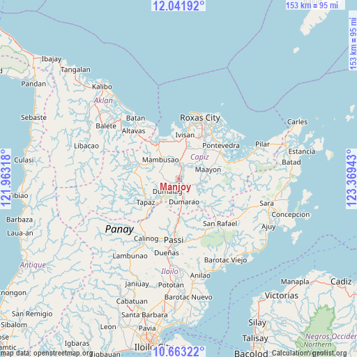
Manjoy GPS coordinates[2]
11° 21' 12.24" North, 122° 39' 58.68" East
| Map corner | latitude | longitude |
|---|---|---|
| Upper-left | 12.04192°, | 121.96318° |
| Center: | 11.3534°, | 122.6663° |
| Lower-right: | 10.66322°, | 123.36943° |
| Map W x H: | 153.3×153.3 km | = 95.3×95.3mi |
| max Lat: | 20.78733° ⇑52.8% North |
| Manjoy: | 11.3534° |
| min Lat: | ⇓47.2% South 4.65442° |
| min Long | Manjoy | max Long |
| 117.04868° | 122.6663° | 126.58417° |
| W 48.1%⇐ | ⇒51.9% E |
Elevation
Elevation of Manjoy is 18 m = 59 ft, and this is 69.9 m = 229 ft below average elevation for this country.
| Max E: |
2262 m = 7421 ft | 57.6% |
| Avg. | 87.9 m = 288 ft | |
| Manjoy | 18 m = 59 ft | |
Min E: |
-2 m = -7 ft | 42.4% |
See also: Philippines elevation on elevation.city.
Geographical zone
Manjoy is located in North Torrid zone (between Equator and Tropic of Cancer). Distance of Equator is 1262.4 km =784.4 mi to South.| Distance of | km | miles | from Manjoy |
|---|---|---|---|
| North Pole | 8744.7 | 5433.7 | to North |
| Arctic Circle | 6138.8 | 3814.5 | to North |
| Tropic Cancer | 1343.5 | 834.8 | to North |
| Equator | 1262.4 | 784.4 | to South |


Nearby cities:
15 places around Manjoy: (largest is in red/bold)
• Bungsuan
13 km =8.1 mi,  164°
164°
• Capaga
12.9 km =8 mi,  43°
43°
• Consolacion
4.6 km =2.9 mi,  232°
232°
• Cuartero
1.5 km =0.9 mi,  166°
166°
• Dao
5 km =3.1 mi,  25°
25°
• Dumalag
6.9 km =4.3 mi,  222°
222°
• Dumarao
10.1 km =6.3 mi, 165°
• Duran
13 km =8.1 mi, 218°
• Lacaron
11.3 km =7 mi,  47°
47°
• Maayon
13.6 km =8.5 mi,  74°
74°
• Mambusao
11.6 km =7.2 mi,  320°
320°
• Mangoso
7.8 km =4.8 mi,  336°
336°
• Masonogan
2 km =1.2 mi, 30°
• Santa Angel
5.9 km =3.7 mi,  208°
208°
• Sigma
7.6 km =4.7 mi,  359°
359°
Sources, notices
• [Note1] Compared only with cities in Philippines existing in our database
• [Src1] Map data: © OpenStreetMap contributors (CC-BY-SA)
• [Src2] Other city data from geonames.org with taken over terms of usage.
• [Src3] Geographical zone / Annual Mean Temperature by Robert A. Rohde @ Wikipedia
