Malangas geodata
Malangas (Zamboanga Peninsula) is a seat of a third-order administrative division; located in Philippines in Asia/Manila (GMT+8) time zone. With population of 8,473 people, there are 733 cities with bigger population in this country. Compared to other cities in Philippines, 85.7% of cities are located further ↑North; 53.7% of cities are located further ←West and 53.5% of cities have lower elevation than Malangas. Note1
Administrative division(s):
- Level 1: Zamboanga Peninsula
- Level 2: Province of Zamboanga Sibugay
- Level 3: Malangas


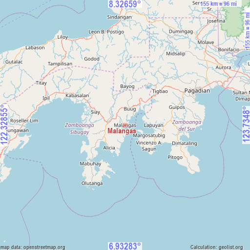
Malangas GPS coordinates[2]
7° 37' 49.008" North, 123° 1' 54.012" East
| Map corner | latitude | longitude |
|---|---|---|
| Upper-left | 8.32659°, | 122.32855° |
| Center: | 7.63028°, | 123.03167° |
| Lower-right: | 6.93283°, | 123.7348° |
| Map W x H: | 155×155 km | = 96.3×96.3mi |
| max Lat: | 20.78733° ⇑85.7% North |
| Malangas: | 7.63028° |
| min Lat: | ⇓14.3% South 4.65442° |
| min Long | Malangas | max Long |
| 117.04868° | 123.03167° | 126.58417° |
| W 53.7%⇐ | ⇒46.3% E |
Elevation
Elevation of Malangas is 26 m = 85 ft, and this is 61.9 m = 203 ft below average elevation for this country.
| Max E: |
2262 m = 7421 ft | 46.5% |
| Avg. | 87.9 m = 288 ft | |
| Malangas | 26 m = 85 ft | |
Min E: |
-2 m = -7 ft | 53.5% |
See also: Philippines elevation on elevation.city.
Geographical zone
Malangas is located in North Torrid zone (between Equator and Tropic of Cancer). Distance of Equator is 848.4 km =527.2 mi to South.| Distance of | km | miles | from Malangas |
|---|---|---|---|
| North Pole | 9158.7 | 5691 | to North |
| Arctic Circle | 6552.8 | 4071.7 | to North |
| Tropic Cancer | 1757.5 | 1092.1 | to North |
| Equator | 848.4 | 527.2 | to South |


Nearby cities:
15 places around Malangas: (largest is in red/bold)
• Alicia
17.1 km =10.6 mi,  220°
220°
• Buug
11.4 km =7.1 mi,  15°
15°
• Del Monte
10.9 km =6.8 mi,  346°
346°
• Diplahan
9.7 km =6 mi, 350°
• Dipolo
19.3 km =12 mi,  28°
28°
• Ganyangan
14.5 km =9 mi,  291°
291°
• Imelda
8.8 km =5.5 mi,  282°
282°
• Kawayan
20.3 km =12.6 mi,  239°
239°
• Kumalarang
18 km =11.2 mi,  43°
43°
• La Dicha
6 km =3.7 mi,  327°
327°
• Lapuyan
18 km =11.2 mi,  87°
87°
• Lumbog
20.4 km =12.7 mi,  113°
113°
• Margosatubig
15.9 km =9.9 mi, 111°
• Monching
20.5 km =12.7 mi,  297°
297°
• Siay
20 km =12.4 mi, 291°
Sources, notices
• [Note1] Compared only with cities in Philippines existing in our database
• [Src1] Map data: © OpenStreetMap contributors (CC-BY-SA)
• [Src2] Other city data from geonames.org with taken over terms of usage.
• [Src3] Geographical zone / Annual Mean Temperature by Robert A. Rohde @ Wikipedia
