Ganyangan geodata
Ganyangan (Zamboanga Peninsula) is a populated place; located in Philippines in Asia/Manila (GMT+8) time zone. With population of 2,169 people, there are 3953 cities with bigger population in this country. Compared to other cities in Philippines, 85.4% of cities are located further ↑North; 51.7% of cities are located further ←West and 89.7% of cities have higher elevation than Ganyangan. Note1
Administrative division(s):
- Level 1: Zamboanga Peninsula
- Level 2: Province of Zamboanga Sibugay
- Level 3: Imelda


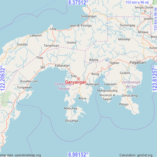
Ganyangan GPS coordinates[2]
7° 40' 44.004" North, 122° 54' 33.984" East
| Map corner | latitude | longitude |
|---|---|---|
| Upper-left | 8.37512°, | 122.20632° |
| Center: | 7.67889°, | 122.90944° |
| Lower-right: | 6.98152°, | 123.61257° |
| Map W x H: | 155×155 km | = 96.3×96.3mi |
| max Lat: | 20.78733° ⇑85.4% North |
| Ganyangan: | 7.67889° |
| min Lat: | ⇓14.6% South 4.65442° |
| min Long | Ganyangan | max Long |
| 117.04868° | 122.90944° | 126.58417° |
| W 51.7%⇐ | ⇒48.3% E |
Elevation
Elevation of Ganyangan is 7 m = 23 ft, and this is 80.9 m = 265 ft below average elevation for this country.
| Max E: |
2262 m = 7421 ft | 89.7% |
| Avg. | 87.9 m = 288 ft | |
| Ganyangan | 7 m = 23 ft | |
Min E: |
-2 m = -7 ft | 10.3% |
See also: Philippines elevation on elevation.city.
Geographical zone
Ganyangan is located in North Torrid zone (between Equator and Tropic of Cancer). Distance of Equator is 853.8 km =530.5 mi to South.| Distance of | km | miles | from Ganyangan |
|---|---|---|---|
| North Pole | 9153.2 | 5687.5 | to North |
| Arctic Circle | 6547.4 | 4068.4 | to North |
| Tropic Cancer | 1752.1 | 1088.7 | to North |
| Equator | 853.8 | 530.5 | to South |


Nearby cities:
15 places around Ganyangan: (largest is in red/bold)
• Alicia
18.5 km =11.5 mi,  172°
172°
• Batu
12.1 km =7.5 mi,  313°
313°
• Buug
17.5 km =10.9 mi,  71°
71°
• Del Monte
12.1 km =7.5 mi,  64°
64°
• Diplahan
12.5 km =7.8 mi, 70°
• Imelda
6 km =3.7 mi,  126°
126°
• Kabasalan
20.6 km =12.8 mi, 309°
• Katipunan
13.8 km =8.6 mi,  219°
219°
• Kawayan
16.2 km =10.1 mi,  194°
194°
• La Dicha
10.2 km =6.3 mi,  91°
91°
• Malangas
14.5 km =9 mi,  111°
111°
• Monching
6.3 km =3.9 mi, 310°
• Naga
20.2 km =12.6 mi,  300°
300°
• Payao
15.6 km =9.7 mi,  228°
228°
• Siay
5.5 km =3.4 mi,  290°
290°
Sources, notices
• [Note1] Compared only with cities in Philippines existing in our database
• [Src1] Map data: © OpenStreetMap contributors (CC-BY-SA)
• [Src2] Other city data from geonames.org with taken over terms of usage.
• [Src3] Geographical zone / Annual Mean Temperature by Robert A. Rohde @ Wikipedia
