Maao geodata
Maao (Western Visayas) is a populated place; located in Philippines in Asia/Manila (GMT+8) time zone. With population of 25,837 people, there are 314 cities with bigger population in this country. Compared to other cities in Philippines, 63.4% of cities are located further ↑North; 53.1% of cities are located further ←West and 72.4% of cities have lower elevation than Maao. Note1
Administrative division(s):
- Level 1: Western Visayas
- Level 2: Province of Negros Occidental
- Level 3: Bago City


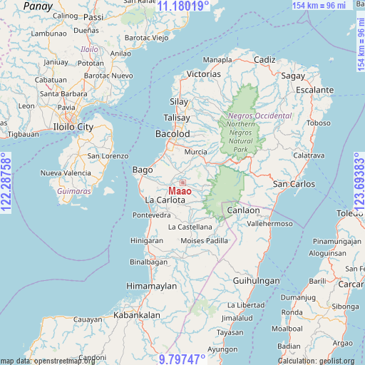
Maao GPS coordinates[2]
10° 29' 22.56" North, 122° 59' 26.52" East
| Map corner | latitude | longitude |
|---|---|---|
| Upper-left | 11.18019°, | 122.28758° |
| Center: | 10.4896°, | 122.9907° |
| Lower-right: | 9.79747°, | 123.69383° |
| Map W x H: | 153.7×153.7 km | = 95.5×95.5mi |
| max Lat: | 20.78733° ⇑63.4% North |
| Maao: | 10.4896° |
| min Lat: | ⇓36.6% South 4.65442° |
| min Long | Maao | max Long |
| 117.04868° | 122.9907° | 126.58417° |
| W 53.1%⇐ | ⇒46.9% E |
Elevation
Elevation of Maao is 59 m = 194 ft, and this is 28.9 m = 95 ft below average elevation for this country.
| Max E: |
2262 m = 7421 ft | 27.6% |
| Avg. | 87.9 m = 288 ft | |
| Maao | 59 m = 194 ft | |
Min E: |
-2 m = -7 ft | 72.4% |
See also: Philippines elevation on elevation.city.
Geographical zone
Maao is located in North Torrid zone (between Equator and Tropic of Cancer). Distance of Equator is 1166.3 km =724.7 mi to South.| Distance of | km | miles | from Maao |
|---|---|---|---|
| North Pole | 8840.7 | 5493.4 | to North |
| Arctic Circle | 6234.8 | 3874.1 | to North |
| Tropic Cancer | 1439.6 | 894.5 | to North |
| Equator | 1166.3 | 724.7 | to South |


Nearby cities:
15 places around Maao: (largest is in red/bold)
• Araal
9.7 km =6 mi,  143°
143°
• Atipuluhan
4.1 km =2.5 mi,  310°
310°
• Busay
12.6 km =7.8 mi,  295°
295°
• Cansilayan
8.4 km =5.2 mi,  21°
21°
• Caridad
10.2 km =6.3 mi,  274°
274°
• Dulao
8.2 km =5.1 mi,  315°
315°
• Haguimit
10.4 km =6.5 mi,  163°
163°
• La Carlota
10.5 km =6.5 mi,  226°
226°
• La Granja
9.1 km =5.7 mi,  180°
180°
• Minuyan
12.8 km =8 mi,  77°
77°
• Napoles
10.3 km =6.4 mi,  278°
278°
• Sagasa
10.9 km =6.8 mi,  257°
257°
• San Miguel
8.9 km =5.5 mi, 157°
• San Miguel
11.5 km =7.1 mi,  61°
61°
• Sibucao
13.9 km =8.6 mi, 234°
Sources, notices
• [Note1] Compared only with cities in Philippines existing in our database
• [Src1] Map data: © OpenStreetMap contributors (CC-BY-SA)
• [Src2] Other city data from geonames.org with taken over terms of usage.
• [Src3] Geographical zone / Annual Mean Temperature by Robert A. Rohde @ Wikipedia
