Lingion geodata
Lingion (Northern Mindanao) is a populated place; located in Philippines in Asia/Manila (GMT+8) time zone. With population of 4,321 people, there are 1575 cities with bigger population in this country. Compared to other cities in Philippines, 80.8% of cities are located further ↑North; 81% of cities are located further ←West and 95.5% of cities have lower elevation than Lingion. Note1
Administrative division(s):
- Level 1: Northern Mindanao
- Level 2: Province of Bukidnon
- Level 3: Talakag


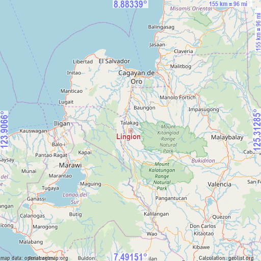
Lingion GPS coordinates[2]
8° 11' 17.016" North, 124° 36' 34.992" East
| Map corner | latitude | longitude |
|---|---|---|
| Upper-left | 8.88339°, | 123.9066° |
| Center: | 8.18806°, | 124.60972° |
| Lower-right: | 7.49151°, | 125.31285° |
| Map W x H: | 154.8×154.8 km | = 96.2×96.2mi |
| max Lat: | 20.78733° ⇑80.8% North |
| Lingion: | 8.18806° |
| min Lat: | ⇓19.2% South 4.65442° |
| min Long | Lingion | max Long |
| 117.04868° | 124.60972° | 126.58417° |
| W 81%⇐ | ⇒19% E |
Elevation
Elevation of Lingion is 460 m = 1509 ft, and this is 372.1 m = 1221 ft above average elevation for this country.
| Max E: |
2262 m = 7421 ft | 4.5% |
| Lingion | 460 m 1509 ft | |
| Avg. | 87.9 m = 288 ft | |
Min E: |
-2 m = -7 ft | 95.5% |
See also: Philippines elevation on elevation.city.
Geographical zone
Lingion is located in North Torrid zone (between Equator and Tropic of Cancer). Distance of Equator is 910.4 km =565.7 mi to South.| Distance of | km | miles | from Lingion |
|---|---|---|---|
| North Pole | 9096.6 | 5652.4 | to North |
| Arctic Circle | 6490.7 | 4033.1 | to North |
| Tropic Cancer | 1695.5 | 1053.5 | to North |
| Equator | 910.4 | 565.7 | to South |


Nearby cities:
15 places around Lingion: (largest is in red/bold)
• Cosina
9.2 km =5.7 mi,  173°
173°
• Dagumba-an
4.4 km =2.7 mi,  208°
208°
• Dorsalanam
13.5 km =8.4 mi,  348°
348°
• Indulang
11.2 km =7 mi,  194°
194°
• Libona
21.7 km =13.5 mi,  39°
39°
• Liboran
19 km =11.8 mi,  13°
13°
• Lingating
16.1 km =10 mi, 7°
• Lumbia
23.2 km =14.4 mi,  355°
355°
• Pongol
18.3 km =11.4 mi,  56°
56°
• Salimbalan
15.6 km =9.7 mi,  52°
52°
• San Isidro
8 km =5 mi, 346°
• Talakag
5.2 km =3.2 mi, 348°
• Taypano
21.1 km =13.1 mi,  344°
344°
• Ticala-an
17 km =10.6 mi,  175°
175°
• Tignapalan
9.3 km =5.8 mi, 335°
Sources, notices
• [Note1] Compared only with cities in Philippines existing in our database
• [Src1] Map data: © OpenStreetMap contributors (CC-BY-SA)
• [Src2] Other city data from geonames.org with taken over terms of usage.
• [Src3] Geographical zone / Annual Mean Temperature by Robert A. Rohde @ Wikipedia
