Pongol geodata
Pongol (Northern Mindanao) is a populated place; located in Philippines in Asia/Manila (GMT+8) time zone. With population of 3,421 people, there are 2120 cities with bigger population in this country. Compared to other cities in Philippines, 80.1% of cities are located further ↑North; 83.2% of cities are located further ←West and 97.4% of cities have lower elevation than Pongol. Note1
Administrative division(s):
- Level 1: Northern Mindanao
- Level 2: Province of Bukidnon
- Level 3: Libona


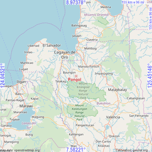
Pongol GPS coordinates[2]
8° 16' 42.996" North, 124° 44' 53.988" East
| Map corner | latitude | longitude |
|---|---|---|
| Upper-left | 8.97378°, | 124.04521° |
| Center: | 8.27861°, | 124.74833° |
| Lower-right: | 7.58221°, | 125.45146° |
| Map W x H: | 154.7×154.7 km | = 96.1×96.1mi |
| max Lat: | 20.78733° ⇑80.1% North |
| Pongol: | 8.27861° |
| min Lat: | ⇓19.9% South 4.65442° |
| min Long | Pongol | max Long |
| 117.04868° | 124.74833° | 126.58417° |
| W 83.2%⇐ | ⇒16.8% E |
Elevation
Elevation of Pongol is 663 m = 2175 ft, and this is 575.1 m = 1887 ft above average elevation for this country.
| Max E: |
2262 m = 7421 ft | 2.6% |
| Pongol | 663 m 2175 ft | |
| Avg. | 87.9 m = 288 ft | |
Min E: |
-2 m = -7 ft | 97.4% |
See also: Philippines elevation on elevation.city.
Geographical zone
Pongol is located in North Torrid zone (between Equator and Tropic of Cancer). Distance of Equator is 920.5 km =572 mi to South.| Distance of | km | miles | from Pongol |
|---|---|---|---|
| North Pole | 9086.6 | 5646.1 | to North |
| Arctic Circle | 6480.7 | 4026.9 | to North |
| Tropic Cancer | 1685.4 | 1047.3 | to North |
| Equator | 920.5 | 572 | to South |


Nearby cities:
15 places around Pongol: (largest is in red/bold)
• Alae
17.7 km =11 mi,  23°
23°
• Damilag
11 km =6.8 mi,  39°
39°
• Dorsalanam
18.2 km =11.3 mi,  279°
279°
• Kalugmanan
12.3 km =7.6 mi,  90°
90°
• Libona
6.9 km =4.3 mi,  347°
347°
• Liboran
13.8 km =8.6 mi,  307°
307°
• Lingating
14.4 km =8.9 mi,  294°
294°
• Lingion
18.3 km =11.4 mi,  236°
236°
• Manolo Fortich
16.3 km =10.1 mi,  51°
51°
• Pontian
16.7 km =10.4 mi, 89°
• Salimbalan
2.9 km =1.8 mi,  260°
260°
• San Isidro
17.2 km =10.7 mi, 262°
• Sankanan
12.8 km =8 mi,  71°
71°
• Santa Fe
8 km =5 mi,  26°
26°
• Talakag
17 km =10.6 mi,  252°
252°
Sources, notices
• [Note1] Compared only with cities in Philippines existing in our database
• [Src1] Map data: © OpenStreetMap contributors (CC-BY-SA)
• [Src2] Other city data from geonames.org with taken over terms of usage.
• [Src3] Geographical zone / Annual Mean Temperature by Robert A. Rohde @ Wikipedia
