Taypano geodata
Taypano (Northern Mindanao) is a populated place; located in Philippines in Asia/Manila (GMT+8) time zone. With population of 2,980 people, there are 2551 cities with bigger population in this country. Compared to other cities in Philippines, 79.5% of cities are located further ↑North; 79.7% of cities are located further ←West and 88.2% of cities have lower elevation than Taypano. Note1
Administrative division(s):
- Level 1: Northern Mindanao
- Level 2: Province of Misamis Oriental
- Level 3: Cagayan De Oro City


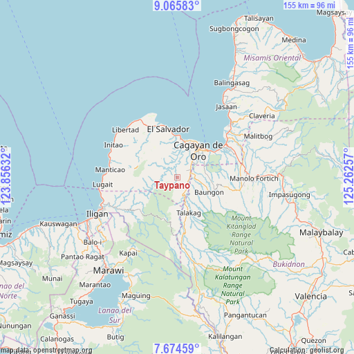
Taypano GPS coordinates[2]
8° 22' 14.988" North, 124° 33' 33.984" East
| Map corner | latitude | longitude |
|---|---|---|
| Upper-left | 9.06583°, | 123.85632° |
| Center: | 8.37083°, | 124.55944° |
| Lower-right: | 7.67459°, | 125.26257° |
| Map W x H: | 154.7×154.7 km | = 96.1×96.1mi |
| max Lat: | 20.78733° ⇑79.5% North |
| Taypano: | 8.37083° |
| min Lat: | ⇓20.5% South 4.65442° |
| min Long | Taypano | max Long |
| 117.04868° | 124.55944° | 126.58417° |
| W 79.7%⇐ | ⇒20.3% E |
Elevation
Elevation of Taypano is 185 m = 607 ft, and this is 97.1 m = 319 ft above average elevation for this country.
| Max E: |
2262 m = 7421 ft | 11.8% |
| Taypano | 185 m 607 ft | |
| Avg. | 87.9 m = 288 ft | |
Min E: |
-2 m = -7 ft | 88.2% |
See also: Philippines elevation on elevation.city.
Geographical zone
Taypano is located in North Torrid zone (between Equator and Tropic of Cancer). Distance of Equator is 930.7 km =578.3 mi to South.| Distance of | km | miles | from Taypano |
|---|---|---|---|
| North Pole | 9076.3 | 5639.7 | to North |
| Arctic Circle | 6470.4 | 4020.5 | to North |
| Tropic Cancer | 1675.2 | 1040.9 | to North |
| Equator | 930.7 | 578.3 | to South |


Nearby cities:
15 places around Taypano: (largest is in red/bold)
• Baikingon
11.3 km =7 mi,  356°
356°
• Barra
16.3 km =10.1 mi,  17°
17°
• Cagayan de Oro
15.7 km =9.8 mi,  37°
37°
• Dorsalanam
7.7 km =4.8 mi,  158°
158°
• Igpit
15.9 km =9.9 mi,  10°
10°
• Liboran
10 km =6.2 mi,  100°
100°
• Lingating
8.8 km =5.5 mi,  119°
119°
• Lumbia
4.7 km =2.9 mi,  53°
53°
• Molugan
18.5 km =11.5 mi,  0°
0°
• Opol
16.8 km =10.4 mi, 4°
• San Isidro
13 km =8.1 mi, 163°
• Sungai
19.4 km =12.1 mi,  297°
297°
• Talakag
15.9 km =9.9 mi, 163°
• Taytay
19.1 km =11.9 mi,  353°
353°
• Tignapalan
12 km =7.5 mi,  171°
171°
Sources, notices
• [Note1] Compared only with cities in Philippines existing in our database
• [Src1] Map data: © OpenStreetMap contributors (CC-BY-SA)
• [Src2] Other city data from geonames.org with taken over terms of usage.
• [Src3] Geographical zone / Annual Mean Temperature by Robert A. Rohde @ Wikipedia
