Lumbia geodata
Lumbia (Northern Mindanao) is a populated place; located in Philippines in Asia/Manila (GMT+8) time zone. With population of 7,863 people, there are 783 cities with bigger population in this country. Compared to other cities in Philippines, 79.4% of cities are located further ↑North; 80.7% of cities are located further ←West and 86.3% of cities have lower elevation than Lumbia. Note1
Administrative division(s):
- Level 1: Northern Mindanao
- Level 2: Province of Misamis Oriental
- Level 3: Cagayan De Oro City


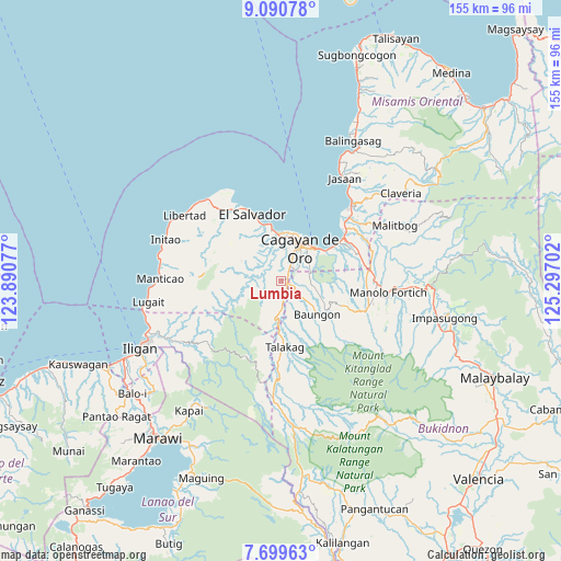
Lumbia GPS coordinates[2]
8° 23' 44.988" North, 124° 35' 38.004" East
| Map corner | latitude | longitude |
|---|---|---|
| Upper-left | 9.09078°, | 123.89077° |
| Center: | 8.39583°, | 124.59389° |
| Lower-right: | 7.69963°, | 125.29702° |
| Map W x H: | 154.7×154.7 km | = 96.1×96.1mi |
| max Lat: | 20.78733° ⇑79.4% North |
| Lumbia: | 8.39583° |
| min Lat: | ⇓20.6% South 4.65442° |
| min Long | Lumbia | max Long |
| 117.04868° | 124.59389° | 126.58417° |
| W 80.7%⇐ | ⇒19.3% E |
Elevation
Elevation of Lumbia is 154 m = 505 ft, and this is 66.1 m = 217 ft above average elevation for this country.
| Max E: |
2262 m = 7421 ft | 13.7% |
| Lumbia | 154 m 505 ft | |
| Avg. | 87.9 m = 288 ft | |
Min E: |
-2 m = -7 ft | 86.3% |
See also: Philippines elevation on elevation.city.
Geographical zone
Lumbia is located in North Torrid zone (between Equator and Tropic of Cancer). Distance of Equator is 933.5 km =580 mi to South.| Distance of | km | miles | from Lumbia |
|---|---|---|---|
| North Pole | 9073.5 | 5638 | to North |
| Arctic Circle | 6467.6 | 4018.8 | to North |
| Tropic Cancer | 1672.4 | 1039.2 | to North |
| Equator | 933.5 | 580 | to South |


Nearby cities:
15 places around Lumbia: (largest is in red/bold)
• Baikingon
9.6 km =6 mi,  332°
332°
• Barra
12.8 km =8 mi,  5°
5°
• Cagayan de Oro
11.3 km =7 mi,  31°
31°
• Dorsalanam
10 km =6.2 mi,  185°
185°
• Igpit
12.8 km =8 mi,  356°
356°
• Libona
16.8 km =10.4 mi,  112°
112°
• Liboran
7.6 km =4.7 mi,  127°
127°
• Lingating
8.1 km =5 mi,  151°
151°
• Molugan
16.1 km =10 mi,  347°
347°
• Opol
14.2 km =8.8 mi, 349°
• San Isidro
15.3 km =9.5 mi,  180°
180°
• Talakag
18.1 km =11.2 mi, 177°
• Taypano
4.7 km =2.9 mi,  233°
233°
• Taytay
17.2 km =10.7 mi,  339°
339°
• Tignapalan
14.8 km =9.2 mi, 188°
Sources, notices
• [Note1] Compared only with cities in Philippines existing in our database
• [Src1] Map data: © OpenStreetMap contributors (CC-BY-SA)
• [Src2] Other city data from geonames.org with taken over terms of usage.
• [Src3] Geographical zone / Annual Mean Temperature by Robert A. Rohde @ Wikipedia
