Liloy geodata
Liloy (Zamboanga Peninsula) is a seat of a third-order administrative division; located in Philippines in Asia/Manila (GMT+8) time zone. With population of 4,784 people, there are 1382 cities with bigger population in this country. Compared to other cities in Philippines, 81.5% of cities are located further ↑North; 52% of cities are located further →East and 70.5% of cities have lower elevation than Liloy. Note1
Administrative division(s):
- Level 1: Zamboanga Peninsula
- Level 2: Province of Zamboanga del Norte
- Level 3: Liloy


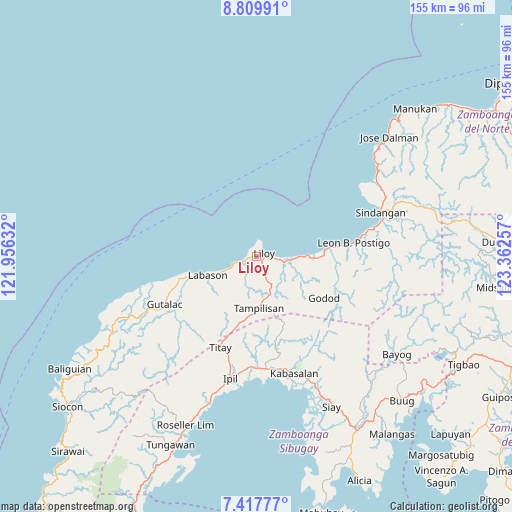
Liloy GPS coordinates[2]
8° 6' 51.984" North, 122° 39' 33.984" East
| Map corner | latitude | longitude |
|---|---|---|
| Upper-left | 8.80991°, | 121.95632° |
| Center: | 8.11444°, | 122.65944° |
| Lower-right: | 7.41777°, | 123.36257° |
| Map W x H: | 154.8×154.8 km | = 96.2×96.2mi |
| max Lat: | 20.78733° ⇑81.5% North |
| Liloy: | 8.11444° |
| min Lat: | ⇓18.5% South 4.65442° |
| min Long | Liloy | max Long |
| 117.04868° | 122.65944° | 126.58417° |
| W 48%⇐ | ⇒52% E |
Elevation
Elevation of Liloy is 53 m = 174 ft, and this is 34.9 m = 115 ft below average elevation for this country.
| Max E: |
2262 m = 7421 ft | 29.5% |
| Avg. | 87.9 m = 288 ft | |
| Liloy | 53 m = 174 ft | |
Min E: |
-2 m = -7 ft | 70.5% |
See also: Philippines elevation on elevation.city.
Geographical zone
Liloy is located in North Torrid zone (between Equator and Tropic of Cancer). Distance of Equator is 902.2 km =560.6 mi to South.| Distance of | km | miles | from Liloy |
|---|---|---|---|
| North Pole | 9104.8 | 5657.5 | to North |
| Arctic Circle | 6498.9 | 4038.2 | to North |
| Tropic Cancer | 1703.7 | 1058.6 | to North |
| Equator | 902.2 | 560.6 | to South |


Nearby cities:
15 places around Liloy: (largest is in red/bold)
• Caracal
20.5 km =12.7 mi,  86°
86°
• Dalangin
30.7 km =19.1 mi,  196°
196°
• Gutalac
31.6 km =19.6 mi,  242°
242°
• Ipil
37.6 km =23.4 mi,  192°
192°
• Kabasalan
37.1 km =23.1 mi,  161°
161°
• Kalawit
16.6 km =10.3 mi,  251°
251°
• Kipit
15.9 km =9.9 mi, 241°
• Labason
16 km =9.9 mi, 251°
• Leon Postigo
30.2 km =18.8 mi,  81°
81°
• Palomoc
23.7 km =14.7 mi, 200°
• Patawag
4.3 km =2.7 mi,  258°
258°
• Salug
13.6 km =8.5 mi, 89°
• Sindangan
39.6 km =24.6 mi,  69°
69°
• Tampilisan
11.2 km =7 mi,  166°
166°
• Titay
36.3 km =22.6 mi, 202°
Sources, notices
• [Note1] Compared only with cities in Philippines existing in our database
• [Src1] Map data: © OpenStreetMap contributors (CC-BY-SA)
• [Src2] Other city data from geonames.org with taken over terms of usage.
• [Src3] Geographical zone / Annual Mean Temperature by Robert A. Rohde @ Wikipedia
