Latung geodata
Latung (Autonomous Region in Muslim Mindanao) is a populated place; located in Philippines in Asia/Manila (GMT+8) time zone. With population of 2,964 people, there are 2575 cities with bigger population in this country. Compared to other cities in Philippines, 99.4% of cities are located further ↑North; 79.9% of cities are located further →East and 95.5% of cities have higher elevation than Latung. Note1
Administrative division(s):
- Level 1: Autonomous Region in Muslim Mindanao
- Level 2: Province of Sulu
- Level 3: Siasi


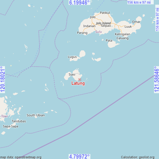
Latung GPS coordinates[2]
5° 30' 0" North, 120° 52' 59.988" East
| Map corner | latitude | longitude |
|---|---|---|
| Upper-left | 6.19946°, | 120.18021° |
| Center: | 5.5°, | 120.88333° |
| Lower-right: | 4.79972°, | 121.58646° |
| Map W x H: | 155.6×155.6 km | = 96.7×96.7mi |
| max Lat: | 20.78733° ⇑99.4% North |
| Latung: | 5.5° |
| min Lat: | ⇓0.6% South 4.65442° |
| min Long | Latung | max Long |
| 117.04868° | 120.88333° | 126.58417° |
| W 20.1%⇐ | ⇒79.9% E |
Elevation
Elevation of Latung is 5 m = 16 ft, and this is 82.9 m = 272 ft below average elevation for this country.
| Max E: |
2262 m = 7421 ft | 95.5% |
| Avg. | 87.9 m = 288 ft | |
| Latung | 5 m = 16 ft | |
Min E: |
-2 m = -7 ft | 4.5% |
See also: Philippines elevation on elevation.city.
Geographical zone
Latung is located in North Torrid zone (between Equator and Tropic of Cancer). Distance of Equator is 611.5 km =380 mi to South.| Distance of | km | miles | from Latung |
|---|---|---|---|
| North Pole | 9395.5 | 5838.1 | to North |
| Arctic Circle | 6789.6 | 4218.9 | to North |
| Tropic Cancer | 1994.4 | 1239.3 | to North |
| Equator | 611.5 | 380 | to South |


Nearby cities:
15 places around Latung: (largest is in red/bold)
• Bawison
48.7 km =30.3 mi,  358°
358°
• Buan
5.7 km =3.5 mi, 357°
• Kulase
45.8 km =28.5 mi,  10°
10°
• Kungtad
7.5 km =4.7 mi,  327°
327°
• Laminusa
7 km =4.3 mi,  28°
28°
• Lugus
23.7 km =14.7 mi,  342°
342°
• Maimbung
50.7 km =31.5 mi,  18°
18°
• Manubul
9.8 km =6.1 mi,  252°
252°
• Panabuan
52.1 km =32.4 mi, 9°
• Parang
46.1 km =28.6 mi,  3°
3°
• Parian Dakula
13.8 km =8.6 mi,  297°
297°
• Payuhan
49.1 km =30.5 mi, 2°
• Siasi
9.2 km =5.7 mi, 303°
• Talipaw
51.2 km =31.8 mi, 27°
• Tunggol
48.7 km =30.3 mi,  38°
38°
Sources, notices
• [Note1] Compared only with cities in Philippines existing in our database
• [Src1] Map data: © OpenStreetMap contributors (CC-BY-SA)
• [Src2] Other city data from geonames.org with taken over terms of usage.
• [Src3] Geographical zone / Annual Mean Temperature by Robert A. Rohde @ Wikipedia
