Balagtasin geodata
Balagtasin (Calabarzon) is a populated place; located in Philippines in Asia/Manila (GMT+8) time zone. With population of 4,050 people, there are 1700 cities with bigger population in this country. Compared to other cities in Philippines, 67.5% of cities are located further ↓South; 74.1% of cities are located further →East and 92.7% of cities have lower elevation than Balagtasin. Note1


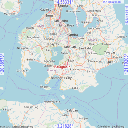
Balagtasin GPS coordinates[2]
13° 54' 6.48" North, 121° 5' 20.04" East
| Map corner | latitude | longitude |
|---|---|---|
| Upper-left | 14.58331°, | 120.38578° |
| Center: | 13.9018°, | 121.0889° |
| Lower-right: | 13.21828°, | 121.79203° |
| Map W x H: | 151.8×151.8 km | = 94.3×94.3mi |
| max Lat: | 20.78733° ⇑32.5% North |
| Balagtasin: | 13.9018° |
| min Lat: | ⇓67.5% South 4.65442° |
| min Long | Balagtasin | max Long |
| 117.04868° | 121.0889° | 126.58417° |
| W 25.9%⇐ | ⇒74.1% E |
Elevation
Elevation of Balagtasin is 314 m = 1030 ft, and this is 226.1 m = 742 ft above average elevation for this country.
| Max E: |
2262 m = 7421 ft | 7.3% |
| Balagtasin | 314 m 1030 ft | |
| Avg. | 87.9 m = 288 ft | |
Min E: |
-2 m = -7 ft | 92.7% |
See also: Philippines elevation on elevation.city.
Geographical zone
Balagtasin is located in North Torrid zone (between Equator and Tropic of Cancer). Distance of this Northern Tropic circle is 1060.2 km =658.8 mi to North.| Distance of | km | miles | from Balagtasin |
|---|---|---|---|
| North Pole | 8461.3 | 5257.6 | to North |
| Arctic Circle | 5855.4 | 3638.4 | to North |
| Tropic Cancer | 1060.2 | 658.8 | to North |
| Equator | 1545.7 | 960.5 | to South |


Nearby cities:
15 places around Balagtasin: (largest is in red/bold)
• Aya
2.8 km =1.7 mi,  106°
106°
• Banaybanay
4.5 km =2.8 mi,  39°
39°
• Bukal
7.3 km =4.5 mi,  175°
175°
• Cuenca
4 km =2.5 mi,  270°
270°
• Lapolapo
9.2 km =5.7 mi,  144°
144°
• Lipa City
9.1 km =5.7 mi,  61°
61°
• Mahabang Parang
9.1 km =5.7 mi,  356°
356°
• Mataas Na Kahoy
6.9 km =4.3 mi,  22°
22°
• Mulauin
8.7 km =5.4 mi,  243°
243°
• Pangao
4.3 km =2.7 mi,  66°
66°
• Rizal
8.1 km =5 mi, 110°
• San Jose
3.1 km =1.9 mi,  147°
147°
• Santo Niño
7.6 km =4.7 mi, 141°
• Talaibon
9 km =5.6 mi, 142°
• Taysan
3.7 km =2.3 mi,  166°
166°
Sources, notices
• [Note1] Compared only with cities in Philippines existing in our database
• [Src1] Map data: © OpenStreetMap contributors (CC-BY-SA)
• [Src2] Other city data from geonames.org with taken over terms of usage.
• [Src3] Geographical zone / Annual Mean Temperature by Robert A. Rohde @ Wikipedia
