Lais geodata
Lais (Davao) is a populated place; located in Philippines in Asia/Manila (GMT+8) time zone. With population of 2,298 people, there are 3685 cities with bigger population in this country. Compared to other cities in Philippines, 96.6% of cities are located further ↑North; 95.1% of cities are located further ←West and 65.1% of cities have higher elevation than Lais. Note1


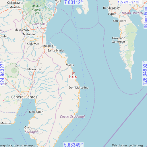
Lais GPS coordinates[2]
6° 19' 58.008" North, 125° 38' 47.004" East
| Map corner | latitude | longitude |
|---|---|---|
| Upper-left | 7.03112°, | 124.94327° |
| Center: | 6.33278°, | 125.64639° |
| Lower-right: | 5.63349°, | 126.34952° |
| Map W x H: | 155.4×155.4 km | = 96.6×96.6mi |
| max Lat: | 20.78733° ⇑96.6% North |
| Lais: | 6.33278° |
| min Lat: | ⇓3.4% South 4.65442° |
| min Long | Lais | max Long |
| 117.04868° | 125.64639° | 126.58417° |
| W 95.1%⇐ | ⇒4.9% E |
Elevation
Elevation of Lais is 14 m = 46 ft, and this is 73.9 m = 242 ft below average elevation for this country.
| Max E: |
2262 m = 7421 ft | 65.1% |
| Avg. | 87.9 m = 288 ft | |
| Lais | 14 m = 46 ft | |
Min E: |
-2 m = -7 ft | 34.9% |
See also: Philippines elevation on elevation.city.
Geographical zone
Lais is located in North Torrid zone (between Equator and Tropic of Cancer). Distance of Equator is 704.1 km =437.5 mi to South.| Distance of | km | miles | from Lais |
|---|---|---|---|
| North Pole | 9302.9 | 5780.6 | to North |
| Arctic Circle | 6697 | 4161.3 | to North |
| Tropic Cancer | 1901.8 | 1181.7 | to North |
| Equator | 704.1 | 437.5 | to South |


Nearby cities:
15 places around Lais: (largest is in red/bold)
• Basiawan
28.5 km =17.7 mi,  321°
321°
• Bolila
9.3 km =5.8 mi,  297°
297°
• Buhangin
20.7 km =12.9 mi,  328°
328°
• Bulacan
36.1 km =22.4 mi, 316°
• Kalian
24.1 km =15 mi,  165°
165°
• Kinangan
7.6 km =4.7 mi,  242°
242°
• Lacaron
14.9 km =9.3 mi, 330°
• Lamitan
28 km =17.4 mi, 167°
• Lapuan
21.8 km =13.5 mi,  163°
163°
• Malita
9.9 km =6.2 mi,  337°
337°
• Pangian
18.3 km =11.4 mi, 322°
• Pung-Pang
27.3 km =17 mi,  312°
312°
• Santa Maria
31.3 km =19.4 mi, 321°
• Talagutong
8 km =5 mi, 162°
• Tubalan
20.1 km =12.5 mi, 333°
Sources, notices
• [Note1] Compared only with cities in Philippines existing in our database
• [Src1] Map data: © OpenStreetMap contributors (CC-BY-SA)
• [Src2] Other city data from geonames.org with taken over terms of usage.
• [Src3] Geographical zone / Annual Mean Temperature by Robert A. Rohde @ Wikipedia
