Lamitan geodata
Lamitan (Davao) is a populated place; located in Philippines in Asia/Manila (GMT+8) time zone. With population of 3,241 people, there are 2267 cities with bigger population in this country. Compared to other cities in Philippines, 97.5% of cities are located further ↑North; 95.7% of cities are located further ←West and 50.3% of cities have higher elevation than Lamitan. Note1


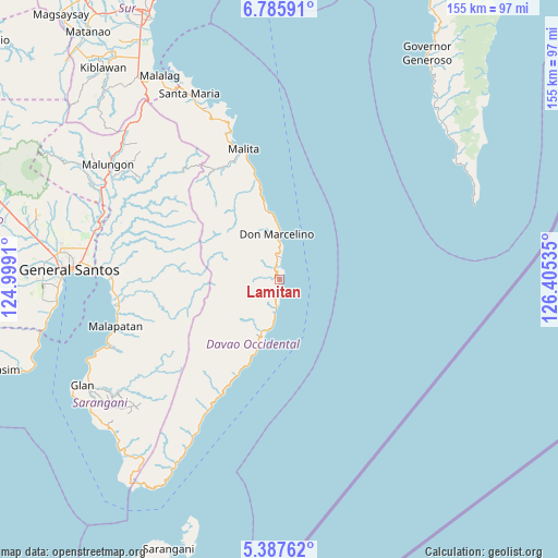
Lamitan GPS coordinates[2]
6° 5' 13.992" North, 125° 42' 7.992" East
| Map corner | latitude | longitude |
|---|---|---|
| Upper-left | 6.78591°, | 124.9991° |
| Center: | 6.08722°, | 125.70222° |
| Lower-right: | 5.38762°, | 126.40535° |
| Map W x H: | 155.5×155.5 km | = 96.6×96.6mi |
| max Lat: | 20.78733° ⇑97.5% North |
| Lamitan: | 6.08722° |
| min Lat: | ⇓2.5% South 4.65442° |
| min Long | Lamitan | max Long |
| 117.04868° | 125.70222° | 126.58417° |
| W 95.7%⇐ | ⇒4.3% E |
Elevation
Elevation of Lamitan is 23 m = 75 ft, and this is 64.9 m = 213 ft below average elevation for this country.
| Max E: |
2262 m = 7421 ft | 50.3% |
| Avg. | 87.9 m = 288 ft | |
| Lamitan | 23 m = 75 ft | |
Min E: |
-2 m = -7 ft | 49.7% |
See also: Philippines elevation on elevation.city.
Geographical zone
Lamitan is located in North Torrid zone (between Equator and Tropic of Cancer). Distance of Equator is 676.8 km =420.5 mi to South.| Distance of | km | miles | from Lamitan |
|---|---|---|---|
| North Pole | 9330.2 | 5797.5 | to North |
| Arctic Circle | 6724.3 | 4178.3 | to North |
| Tropic Cancer | 1929.1 | 1198.7 | to North |
| Equator | 676.8 | 420.5 | to South |


Nearby cities:
15 places around Lamitan: (largest is in red/bold)
• Alabel
45.6 km =28.3 mi,  272°
272°
• Bolila
34.8 km =21.6 mi,  335°
335°
• Caburan
20 km =12.4 mi,  199°
199°
• Culaman
14.9 km =9.3 mi, 198°
• Kalbay
46.3 km =28.8 mi,  209°
209°
• Kalian
4 km =2.5 mi,  356°
356°
• Kinangan
27.1 km =16.8 mi,  331°
331°
• Lacaron
42.5 km =26.4 mi, 341°
• Lais
28 km =17.4 mi,  347°
347°
• Lapuan
6.4 km =4 mi, 358°
• Malita
37.8 km =23.5 mi, 344°
• Mangili
9.5 km =5.9 mi,  192°
192°
• Pangian
45.2 km =28.1 mi, 337°
• Suyan
35.2 km =21.9 mi, 265°
• Talagutong
20.1 km =12.5 mi, 349°
Sources, notices
• [Note1] Compared only with cities in Philippines existing in our database
• [Src1] Map data: © OpenStreetMap contributors (CC-BY-SA)
• [Src2] Other city data from geonames.org with taken over terms of usage.
• [Src3] Geographical zone / Annual Mean Temperature by Robert A. Rohde @ Wikipedia
