Jampang geodata
Jampang (Central Visayas) is a populated place; located in Philippines in Asia/Manila (GMT+8) time zone. With population of 2,189 people, there are 3909 cities with bigger population in this country. Compared to other cities in Philippines, 69.3% of cities are located further ↑North; 64% of cities are located further ←West and 70.5% of cities have lower elevation than Jampang. Note1


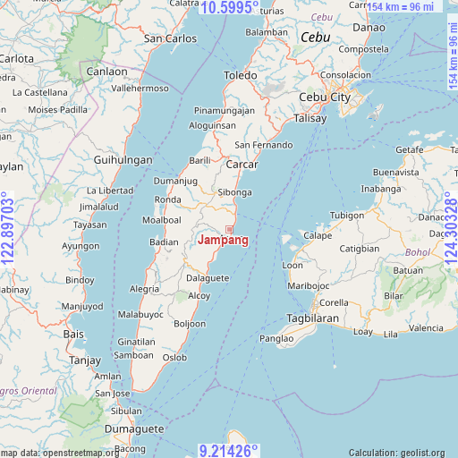
Jampang GPS coordinates[2]
9° 54' 27.396" North, 123° 36' 0.54" East
| Map corner | latitude | longitude |
|---|---|---|
| Upper-left | 10.5995°, | 122.89703° |
| Center: | 9.90761°, | 123.60015° |
| Lower-right: | 9.21426°, | 124.30328° |
| Map W x H: | 154×154 km | = 95.7×95.7mi |
| max Lat: | 20.78733° ⇑69.3% North |
| Jampang: | 9.90761° |
| min Lat: | ⇓30.7% South 4.65442° |
| min Long | Jampang | max Long |
| 117.04868° | 123.60015° | 126.58417° |
| W 64%⇐ | ⇒36% E |
Elevation
Elevation of Jampang is 53 m = 174 ft, and this is 34.9 m = 115 ft below average elevation for this country.
| Max E: |
2262 m = 7421 ft | 29.5% |
| Avg. | 87.9 m = 288 ft | |
| Jampang | 53 m = 174 ft | |
Min E: |
-2 m = -7 ft | 70.5% |
See also: Philippines elevation on elevation.city.
Geographical zone
Jampang is located in North Torrid zone (between Equator and Tropic of Cancer). Distance of Equator is 1101.6 km =684.5 mi to South.| Distance of | km | miles | from Jampang |
|---|---|---|---|
| North Pole | 8905.4 | 5533.6 | to North |
| Arctic Circle | 6299.6 | 3914.4 | to North |
| Tropic Cancer | 1504.3 | 934.7 | to North |
| Equator | 1101.6 | 684.5 | to South |


Nearby cities:
15 places around Jampang: (largest is in red/bold)
• Argao
3.2 km =2 mi,  189°
189°
• Binlod
1.4 km =0.9 mi,  33°
33°
• Bogo
6.9 km =4.3 mi,  214°
214°
• Bulasa
3.3 km =2.1 mi,  35°
35°
• Cansuje
11.5 km =7.1 mi,  278°
278°
• Casay
11.2 km =7 mi, 209°
• Cawayan
13.7 km =8.5 mi, 212°
• Dalaguete
17.8 km =11.1 mi,  203°
203°
• Langtad
1.9 km =1.2 mi,  166°
166°
• Mantalongon
18.6 km =11.6 mi,  234°
234°
• Ocaña
17.8 km =11.1 mi,  8°
8°
• Sibonga
12.3 km =7.6 mi, 8°
• Simala
7.5 km =4.7 mi, 13°
• Tapon
17.1 km =10.6 mi, 207°
• Tubod
10.3 km =6.4 mi,  342°
342°
Sources, notices
• [Note1] Compared only with cities in Philippines existing in our database
• [Src1] Map data: © OpenStreetMap contributors (CC-BY-SA)
• [Src2] Other city data from geonames.org with taken over terms of usage.
• [Src3] Geographical zone / Annual Mean Temperature by Robert A. Rohde @ Wikipedia
