Idtig geodata
Idtig (Autonomous Region in Muslim Mindanao) is a populated place; located in Philippines in Asia/Manila (GMT+8) time zone. With population of 3,969 people, there are 1750 cities with bigger population in this country. Compared to other cities in Philippines, 93.2% of cities are located further ↑North; 83.6% of cities are located further ←West and 70.2% of cities have higher elevation than Idtig. Note1
Administrative division(s):
- Level 1: Autonomous Region in Muslim Mindanao
- Level 2: Province of Maguindanao
- Level 3: Gen. S.K. Pendatun


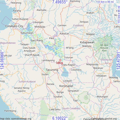
Idtig GPS coordinates[2]
6° 47' 56.004" North, 124° 46' 22.008" East
| Map corner | latitude | longitude |
|---|---|---|
| Upper-left | 7.49655°, | 124.06966° |
| Center: | 6.79889°, | 124.77278° |
| Lower-right: | 6.10022°, | 125.47591° |
| Map W x H: | 155.3×155.3 km | = 96.5×96.5mi |
| max Lat: | 20.78733° ⇑93.2% North |
| Idtig: | 6.79889° |
| min Lat: | ⇓6.8% South 4.65442° |
| min Long | Idtig | max Long |
| 117.04868° | 124.77278° | 126.58417° |
| W 83.6%⇐ | ⇒16.4% E |
Elevation
Elevation of Idtig is 12 m = 39 ft, and this is 75.9 m = 249 ft below average elevation for this country.
| Max E: |
2262 m = 7421 ft | 70.2% |
| Avg. | 87.9 m = 288 ft | |
| Idtig | 12 m = 39 ft | |
Min E: |
-2 m = -7 ft | 29.8% |
See also: Philippines elevation on elevation.city.
Geographical zone
Idtig is located in North Torrid zone (between Equator and Tropic of Cancer). Distance of Equator is 756 km =469.8 mi to South.| Distance of | km | miles | from Idtig |
|---|---|---|---|
| North Pole | 9251.1 | 5748.4 | to North |
| Arctic Circle | 6645.2 | 4129.1 | to North |
| Tropic Cancer | 1850 | 1149.5 | to North |
| Equator | 756 | 469.8 | to South |


Nearby cities:
15 places around Idtig: (largest is in red/bold)
• Badak
7.9 km =4.9 mi,  312°
312°
• Bual
15.2 km =9.4 mi,  91°
91°
• Buluan
9.3 km =5.8 mi,  159°
159°
• Damawato
11.1 km =6.9 mi,  173°
173°
• Datu Paglas
9.2 km =5.7 mi,  112°
112°
• Digal
5.7 km =3.5 mi,  152°
152°
• Kalandagan
14.4 km =8.9 mi,  201°
201°
• Katico
6.2 km =3.9 mi,  226°
226°
• Mamali
14.1 km =8.8 mi,  258°
258°
• Mariano Marcos
13.8 km =8.6 mi,  238°
238°
• Minapan
9.6 km =6 mi,  79°
79°
• Pimbalayan
13.6 km =8.5 mi, 305°
• President Quirino
11.3 km =7 mi, 200°
• Sambuluan
12.4 km =7.7 mi,  319°
319°
• Tulunan
12.2 km =7.6 mi,  71°
71°
Sources, notices
• [Note1] Compared only with cities in Philippines existing in our database
• [Src1] Map data: © OpenStreetMap contributors (CC-BY-SA)
• [Src2] Other city data from geonames.org with taken over terms of usage.
• [Src3] Geographical zone / Annual Mean Temperature by Robert A. Rohde @ Wikipedia
