Katico geodata
Katico (Autonomous Region in Muslim Mindanao) is a populated place; located in Philippines in Asia/Manila (GMT+8) time zone. With population of 3,932 people, there are 1770 cities with bigger population in this country. Compared to other cities in Philippines, 93.5% of cities are located further ↑North; 82.9% of cities are located further ←West and 50.3% of cities have higher elevation than Katico. Note1
Administrative division(s):
- Level 1: Autonomous Region in Muslim Mindanao
- Level 2: Province of Maguindanao


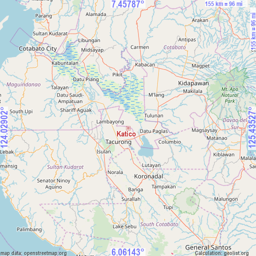
Katico GPS coordinates[2]
6° 45' 36.54" North, 124° 43' 55.704" East
| Map corner | latitude | longitude |
|---|---|---|
| Upper-left | 7.45787°, | 124.02902° |
| Center: | 6.76015°, | 124.73214° |
| Lower-right: | 6.06143°, | 125.43527° |
| Map W x H: | 155.3×155.3 km | = 96.5×96.5mi |
| max Lat: | 20.78733° ⇑93.5% North |
| Katico: | 6.76015° |
| min Lat: | ⇓6.5% South 4.65442° |
| min Long | Katico | max Long |
| 117.04868° | 124.73214° | 126.58417° |
| W 82.9%⇐ | ⇒17.1% E |
Elevation
Elevation of Katico is 23 m = 75 ft, and this is 64.9 m = 213 ft below average elevation for this country.
| Max E: |
2262 m = 7421 ft | 50.3% |
| Avg. | 87.9 m = 288 ft | |
| Katico | 23 m = 75 ft | |
Min E: |
-2 m = -7 ft | 49.7% |
See also: Philippines elevation on elevation.city.
Geographical zone
Katico is located in North Torrid zone (between Equator and Tropic of Cancer). Distance of Equator is 751.7 km =467.1 mi to South.| Distance of | km | miles | from Katico |
|---|---|---|---|
| North Pole | 9255.4 | 5751 | to North |
| Arctic Circle | 6649.5 | 4131.8 | to North |
| Tropic Cancer | 1854.3 | 1152.2 | to North |
| Equator | 751.7 | 467.1 | to South |


Nearby cities:
15 places around Katico: (largest is in red/bold)
• Badak
9.8 km =6.1 mi,  352°
352°
• Buluan
8.9 km =5.5 mi,  119°
119°
• Damawato
8.8 km =5.5 mi,  139°
139°
• Datu Paglas
13 km =8.1 mi,  86°
86°
• Digal
7.1 km =4.4 mi,  96°
96°
• Gansing
9.9 km =6.2 mi,  241°
241°
• Idtig
6.2 km =3.9 mi,  46°
46°
• Kalandagan
9.1 km =5.7 mi,  185°
185°
• Mamali
9.4 km =5.8 mi,  279°
279°
• Mariano Marcos
7.8 km =4.8 mi,  247°
247°
• New Lagao
11.9 km =7.4 mi, 237°
• Pimbalayan
13.8 km =8.6 mi,  331°
331°
• President Quirino
6.3 km =3.9 mi,  174°
174°
• Tacurong
9.7 km =6 mi,  219°
219°
• Tambak
12.6 km =7.8 mi, 252°
Sources, notices
• [Note1] Compared only with cities in Philippines existing in our database
• [Src1] Map data: © OpenStreetMap contributors (CC-BY-SA)
• [Src2] Other city data from geonames.org with taken over terms of usage.
• [Src3] Geographical zone / Annual Mean Temperature by Robert A. Rohde @ Wikipedia
