Tulunan geodata
Tulunan (Soccsksargen) is a seat of a third-order administrative division; located in Philippines in Asia/Manila (GMT+8) time zone. With population of 9,584 people, there are 644 cities with bigger population in this country. Compared to other cities in Philippines, 93% of cities are located further ↑North; 85.8% of cities are located further ←West and 54.5% of cities have higher elevation than Tulunan. Note1


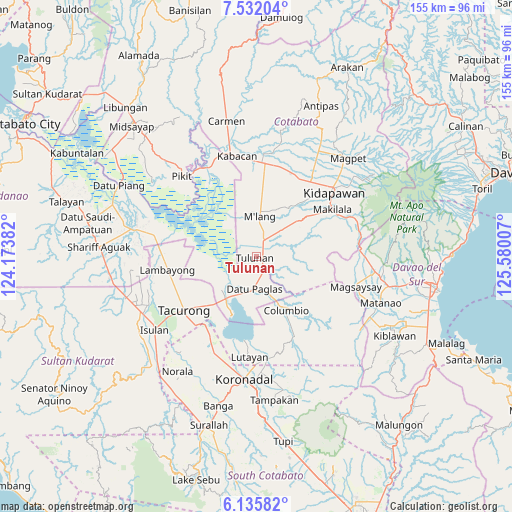
Tulunan GPS coordinates[2]
6° 50' 3.984" North, 124° 52' 36.984" East
| Map corner | latitude | longitude |
|---|---|---|
| Upper-left | 7.53204°, | 124.17382° |
| Center: | 6.83444°, | 124.87694° |
| Lower-right: | 6.13582°, | 125.58007° |
| Map W x H: | 155.2×155.2 km | = 96.4×96.4mi |
| max Lat: | 20.78733° ⇑93% North |
| Tulunan: | 6.83444° |
| min Lat: | ⇓7% South 4.65442° |
| min Long | Tulunan | max Long |
| 117.04868° | 124.87694° | 126.58417° |
| W 85.8%⇐ | ⇒14.2% E |
Elevation
Elevation of Tulunan is 20 m = 66 ft, and this is 67.9 m = 223 ft below average elevation for this country.
| Max E: |
2262 m = 7421 ft | 54.5% |
| Avg. | 87.9 m = 288 ft | |
| Tulunan | 20 m = 66 ft | |
Min E: |
-2 m = -7 ft | 45.5% |
See also: Philippines elevation on elevation.city.
Geographical zone
Tulunan is located in North Torrid zone (between Equator and Tropic of Cancer). Distance of Equator is 759.9 km =472.2 mi to South.| Distance of | km | miles | from Tulunan |
|---|---|---|---|
| North Pole | 9247.1 | 5745.9 | to North |
| Arctic Circle | 6641.3 | 4126.7 | to North |
| Tropic Cancer | 1846 | 1147.1 | to North |
| Equator | 759.9 | 472.2 | to South |


Nearby cities:
15 places around Tulunan: (largest is in red/bold)
• Badak
17.3 km =10.7 mi,  274°
274°
• Bagontapay
4.5 km =2.8 mi,  52°
52°
• Bialong
16.3 km =10.1 mi,  4°
4°
• Bual
5.7 km =3.5 mi,  138°
138°
• Buluan
15.2 km =9.4 mi,  213°
213°
• Columbio
16.7 km =10.4 mi,  156°
156°
• Damawato
18.2 km =11.3 mi, 214°
• Datu Paglas
8.1 km =5 mi,  201°
201°
• Digal
12.7 km =7.9 mi,  224°
224°
• Dunguan
12.9 km =8 mi,  352°
352°
• Idtig
12.2 km =7.6 mi,  251°
251°
• Katico
18 km =11.2 mi,  242°
242°
• Minapan
3 km =1.9 mi, 223°
• Paitan
19.4 km =12.1 mi,  181°
181°
• Sambuluan
20.3 km =12.6 mi,  285°
285°
Sources, notices
• [Note1] Compared only with cities in Philippines existing in our database
• [Src1] Map data: © OpenStreetMap contributors (CC-BY-SA)
• [Src2] Other city data from geonames.org with taken over terms of usage.
• [Src3] Geographical zone / Annual Mean Temperature by Robert A. Rohde @ Wikipedia
