Hermosa geodata
Hermosa (Central Luzon) is a seat of a third-order administrative division; located in Philippines in Asia/Manila (GMT+8) time zone. With population of 33,714 people, there are 252 cities with bigger population in this country. Compared to other cities in Philippines, 75.9% of cities are located further ↓South; 90.8% of cities are located further →East and 70.2% of cities have higher elevation than Hermosa. Note1


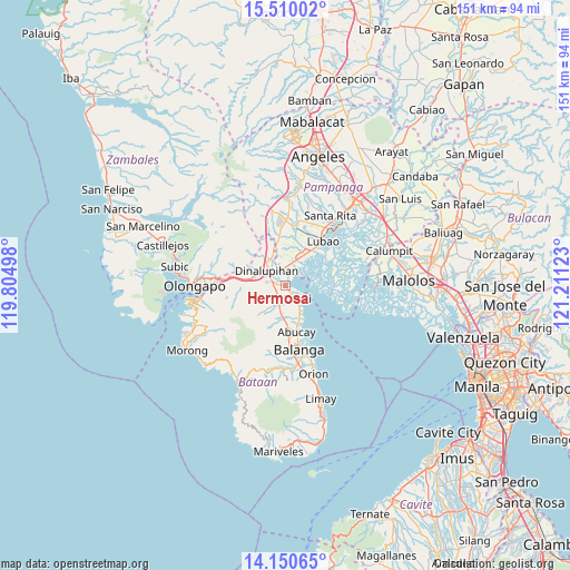
Hermosa GPS coordinates[2]
14° 49' 53.04" North, 120° 30' 29.16" East
| Map corner | latitude | longitude |
|---|---|---|
| Upper-left | 15.51002°, | 119.80498° |
| Center: | 14.8314°, | 120.5081° |
| Lower-right: | 14.15065°, | 121.21123° |
| Map W x H: | 151.1×151.2 km | = 93.9×94mi |
| max Lat: | 20.78733° ⇑24.1% North |
| Hermosa: | 14.8314° |
| min Lat: | ⇓75.9% South 4.65442° |
| min Long | Hermosa | max Long |
| 117.04868° | 120.5081° | 126.58417° |
| W 9.2%⇐ | ⇒90.8% E |
Elevation
Elevation of Hermosa is 12 m = 39 ft, and this is 75.9 m = 249 ft below average elevation for this country.
| Max E: |
2262 m = 7421 ft | 70.2% |
| Avg. | 87.9 m = 288 ft | |
| Hermosa | 12 m = 39 ft | |
Min E: |
-2 m = -7 ft | 29.8% |
See also: Philippines elevation on elevation.city.
Geographical zone
Hermosa is located in North Torrid zone (between Equator and Tropic of Cancer). Distance of this Northern Tropic circle is 956.8 km =594.5 mi to North.| Distance of | km | miles | from Hermosa |
|---|---|---|---|
| North Pole | 8358 | 5193.4 | to North |
| Arctic Circle | 5752.1 | 3574.2 | to North |
| Tropic Cancer | 956.8 | 594.5 | to North |
| Equator | 1649.1 | 1024.7 | to South |


Nearby cities:
15 places around Hermosa: (largest is in red/bold)
• Abucay
11.2 km =7 mi,  165°
165°
• Balsic
4.1 km =2.5 mi,  318°
318°
• Bodega
10.6 km =6.6 mi,  343°
343°
• Calangain
9.2 km =5.7 mi,  36°
36°
• Dinalupihan
8 km =5 mi,  310°
310°
• Gutad
10.9 km =6.8 mi,  349°
349°
• Malusac
12.5 km =7.8 mi,  76°
76°
• Orani
4.6 km =2.9 mi,  137°
137°
• Prado Siongco
5.3 km =3.3 mi,  5°
5°
• Samal
8 km =5 mi,  152°
152°
• San Benito
9 km =5.6 mi,  284°
284°
• San Francisco
15 km =9.3 mi,  15°
15°
• Santa Cruz
11 km =6.8 mi,  34°
34°
• Santa Teresa First
11.9 km =7.4 mi, 26°
• Santiago
8 km =5 mi,  2°
2°
Sources, notices
• [Note1] Compared only with cities in Philippines existing in our database
• [Src1] Map data: © OpenStreetMap contributors (CC-BY-SA)
• [Src2] Other city data from geonames.org with taken over terms of usage.
• [Src3] Geographical zone / Annual Mean Temperature by Robert A. Rohde @ Wikipedia
