Hagdan geodata
Hagdan (Central Visayas) is a populated place; located in Philippines in Asia/Manila (GMT+8) time zone. With population of 3,120 people, there are 2397 cities with bigger population in this country. Compared to other cities in Philippines, 52.9% of cities are located further ↑North; 69.4% of cities are located further ←West and 52.3% of cities have lower elevation than Hagdan. Note1


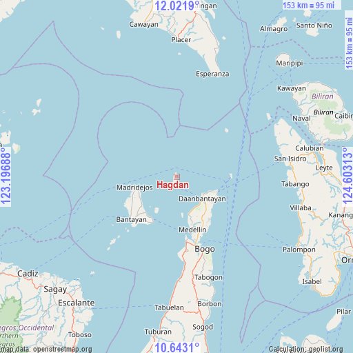
Hagdan GPS coordinates[2]
11° 19' 59.988" North, 123° 54' 0" East
| Map corner | latitude | longitude |
|---|---|---|
| Upper-left | 12.0219°, | 123.19688° |
| Center: | 11.33333°, | 123.9° |
| Lower-right: | 10.6431°, | 124.60313° |
| Map W x H: | 153.3×153.3 km | = 95.3×95.3mi |
| max Lat: | 20.78733° ⇑52.9% North |
| Hagdan: | 11.33333° |
| min Lat: | ⇓47.1% South 4.65442° |
| min Long | Hagdan | max Long |
| 117.04868° | 123.9° | 126.58417° |
| W 69.4%⇐ | ⇒30.6% E |
Elevation
Elevation of Hagdan is 25 m = 82 ft, and this is 62.9 m = 206 ft below average elevation for this country.
| Max E: |
2262 m = 7421 ft | 47.7% |
| Avg. | 87.9 m = 288 ft | |
| Hagdan | 25 m = 82 ft | |
Min E: |
-2 m = -7 ft | 52.3% |
See also: Philippines elevation on elevation.city.
Geographical zone
Hagdan is located in North Torrid zone (between Equator and Tropic of Cancer). Distance of Equator is 1260.1 km =783 mi to South.| Distance of | km | miles | from Hagdan |
|---|---|---|---|
| North Pole | 8746.9 | 5435.1 | to North |
| Arctic Circle | 6141 | 3815.8 | to North |
| Tropic Cancer | 1345.8 | 836.2 | to North |
| Equator | 1260.1 | 783 | to South |


Nearby cities:
15 places around Hagdan: (largest is in red/bold)
• Bachauan
15.7 km =9.8 mi,  153°
153°
• Biton
15.6 km =9.7 mi,  135°
135°
• Daanbantayan
15.8 km =9.8 mi,  127°
127°
• Hilantagaan
18.1 km =11.2 mi,  211°
211°
• Kaongkod
18.3 km =11.4 mi,  239°
239°
• Kauit
17.1 km =10.6 mi,  163°
163°
• Lanao
16 km =9.9 mi,  122°
122°
• Madridejos
18.5 km =11.5 mi,  257°
257°
• Mancilang
17.7 km =11 mi,  251°
251°
• Maya
18.2 km =11.3 mi,  111°
111°
• Pajo
15.8 km =9.8 mi, 130°
• Paypay
15.5 km =9.6 mi, 147°
• Tapilon
15.5 km =9.6 mi, 113°
• Tinaan
18 km =11.2 mi, 245°
• Tominhao
18.3 km =11.4 mi, 126°
Sources, notices
• [Note1] Compared only with cities in Philippines existing in our database
• [Src1] Map data: © OpenStreetMap contributors (CC-BY-SA)
• [Src2] Other city data from geonames.org with taken over terms of usage.
• [Src3] Geographical zone / Annual Mean Temperature by Robert A. Rohde @ Wikipedia
