Gatbo geodata
Gatbo (Bicol) is a populated place; located in Philippines in Asia/Manila (GMT+8) time zone. With population of 2,385 people, there are 3488 cities with bigger population in this country. Compared to other cities in Philippines, 63% of cities are located further ↓South; 60% of cities are located further ←West and 85.4% of cities have lower elevation than Gatbo. Note1


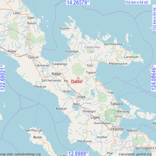
Gatbo GPS coordinates[2]
13° 34' 59.988" North, 123° 22' 59.988" East
| Map corner | latitude | longitude |
|---|---|---|
| Upper-left | 14.26579°, | 122.68021° |
| Center: | 13.58333°, | 123.38333° |
| Lower-right: | 12.8989°, | 124.08646° |
| Map W x H: | 152×152 km | = 94.4×94.4mi |
| max Lat: | 20.78733° ⇑37% North |
| Gatbo: | 13.58333° |
| min Lat: | ⇓63% South 4.65442° |
| min Long | Gatbo | max Long |
| 117.04868° | 123.38333° | 126.58417° |
| W 60%⇐ | ⇒40% E |
Elevation
Elevation of Gatbo is 145 m = 476 ft, and this is 57.1 m = 187 ft above average elevation for this country.
| Max E: |
2262 m = 7421 ft | 14.6% |
| Gatbo | 145 m 476 ft | |
| Avg. | 87.9 m = 288 ft | |
Min E: |
-2 m = -7 ft | 85.4% |
See also: Philippines elevation on elevation.city.
Geographical zone
Gatbo is located in North Torrid zone (between Equator and Tropic of Cancer). Distance of this Northern Tropic circle is 1095.6 km =680.8 mi to North.| Distance of | km | miles | from Gatbo |
|---|---|---|---|
| North Pole | 8496.7 | 5279.6 | to North |
| Arctic Circle | 5890.8 | 3660.4 | to North |
| Tropic Cancer | 1095.6 | 680.8 | to North |
| Equator | 1510.3 | 938.5 | to South |


Nearby cities:
15 places around Gatbo: (largest is in red/bold)
• Ayugan
7.8 km =4.8 mi,  238°
238°
• Bagumbayan
13.1 km =8.1 mi,  176°
176°
• Buracan
12.7 km =7.9 mi,  81°
81°
• Caraycayon
11.4 km =7.1 mi,  71°
71°
• Curry
9.2 km =5.7 mi,  281°
281°
• Himaao
9.9 km =6.2 mi, 244°
• Ocampo
2.8 km =1.7 mi,  196°
196°
• Pawili
13.1 km =8.1 mi, 235°
• Pili
11.7 km =7.3 mi,  322°
322°
• Pinit
3.7 km =2.3 mi,  116°
116°
• Sagrada
9.6 km =6 mi,  128°
128°
• Salvacion
10 km =6.2 mi, 78°
• San Agustin
12.9 km =8 mi,  265°
265°
• Santa Teresita
12.3 km =7.6 mi,  161°
161°
• Tinawagan
13.1 km =8.1 mi,  55°
55°
Sources, notices
• [Note1] Compared only with cities in Philippines existing in our database
• [Src1] Map data: © OpenStreetMap contributors (CC-BY-SA)
• [Src2] Other city data from geonames.org with taken over terms of usage.
• [Src3] Geographical zone / Annual Mean Temperature by Robert A. Rohde @ Wikipedia
