Ayugan geodata
Ayugan (Bicol) is a populated place; located in Philippines in Asia/Manila (GMT+8) time zone. With population of 2,613 people, there are 3087 cities with bigger population in this country. Compared to other cities in Philippines, 62.7% of cities are located further ↓South; 58.8% of cities are located further ←West and 59.5% of cities have lower elevation than Ayugan. Note1


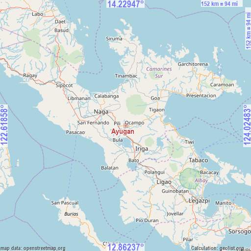
Ayugan GPS coordinates[2]
13° 32' 48.84" North, 123° 19' 18.12" East
| Map corner | latitude | longitude |
|---|---|---|
| Upper-left | 14.22947°, | 122.61858° |
| Center: | 13.5469°, | 123.3217° |
| Lower-right: | 12.86237°, | 124.02483° |
| Map W x H: | 152×152 km | = 94.4×94.4mi |
| max Lat: | 20.78733° ⇑37.3% North |
| Ayugan: | 13.5469° |
| min Lat: | ⇓62.7% South 4.65442° |
| min Long | Ayugan | max Long |
| 117.04868° | 123.3217° | 126.58417° |
| W 58.8%⇐ | ⇒41.2% E |
Elevation
Elevation of Ayugan is 33 m = 108 ft, and this is 54.9 m = 180 ft below average elevation for this country.
| Max E: |
2262 m = 7421 ft | 40.5% |
| Avg. | 87.9 m = 288 ft | |
| Ayugan | 33 m = 108 ft | |
Min E: |
-2 m = -7 ft | 59.5% |
See also: Philippines elevation on elevation.city.
Geographical zone
Ayugan is located in North Torrid zone (between Equator and Tropic of Cancer). Distance of this Northern Tropic circle is 1099.6 km =683.3 mi to North.| Distance of | km | miles | from Ayugan |
|---|---|---|---|
| North Pole | 8500.8 | 5282.2 | to North |
| Arctic Circle | 5894.9 | 3662.9 | to North |
| Tropic Cancer | 1099.6 | 683.3 | to North |
| Equator | 1506.3 | 936 | to South |


Nearby cities:
15 places around Ayugan: (largest is in red/bold)
• Baao
11.3 km =7 mi,  155°
155°
• Bula
9.8 km =6.1 mi,  208°
208°
• Cadlan
8.9 km =5.5 mi,  308°
308°
• Causip
5.4 km =3.4 mi,  230°
230°
• Curry
6.4 km =4 mi,  338°
338°
• Fabrica
7 km =4.3 mi, 205°
• Gatbo
7.8 km =4.8 mi,  58°
58°
• Himaao
2.3 km =1.4 mi,  264°
264°
• Ocampo
6 km =3.7 mi,  76°
76°
• Palestina
10.7 km =6.6 mi, 312°
• Pawili
5.3 km =3.3 mi, 230°
• Pinit
10.3 km =6.4 mi, 76°
• Salvacion
11 km =6.8 mi,  147°
147°
• San Agustin
6.9 km =4.3 mi,  295°
295°
• Tariric
11 km =6.8 mi,  284°
284°
Sources, notices
• [Note1] Compared only with cities in Philippines existing in our database
• [Src1] Map data: © OpenStreetMap contributors (CC-BY-SA)
• [Src2] Other city data from geonames.org with taken over terms of usage.
• [Src3] Geographical zone / Annual Mean Temperature by Robert A. Rohde @ Wikipedia
