Gabao geodata
Gabao (Bicol) is a populated place; located in Philippines in Asia/Manila (GMT+8) time zone. With population of 2,349 people, there are 3562 cities with bigger population in this country. Compared to other cities in Philippines, 57.4% of cities are located further ↓South; 71.4% of cities are located further ←West and 60.9% of cities have lower elevation than Gabao. Note1


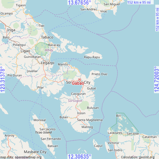
Gabao GPS coordinates[2]
12° 59' 32.64" North, 124° 1' 0.84" East
| Map corner | latitude | longitude |
|---|---|---|
| Upper-left | 13.67656°, | 123.31378° |
| Center: | 12.9924°, | 124.0169° |
| Lower-right: | 12.30635°, | 124.72003° |
| Map W x H: | 152.4×152.4 km | = 94.7×94.7mi |
| max Lat: | 20.78733° ⇑42.6% North |
| Gabao: | 12.9924° |
| min Lat: | ⇓57.4% South 4.65442° |
| min Long | Gabao | max Long |
| 117.04868° | 124.0169° | 126.58417° |
| W 71.4%⇐ | ⇒28.6% E |
Elevation
Elevation of Gabao is 35 m = 115 ft, and this is 52.9 m = 174 ft below average elevation for this country.
| Max E: |
2262 m = 7421 ft | 39.1% |
| Avg. | 87.9 m = 288 ft | |
| Gabao | 35 m = 115 ft | |
Min E: |
-2 m = -7 ft | 60.9% |
See also: Philippines elevation on elevation.city.
Geographical zone
Gabao is located in North Torrid zone (between Equator and Tropic of Cancer). Distance of this Northern Tropic circle is 1161.3 km =721.6 mi to North.| Distance of | km | miles | from Gabao |
|---|---|---|---|
| North Pole | 8562.4 | 5320.4 | to North |
| Arctic Circle | 5956.6 | 3701.3 | to North |
| Tropic Cancer | 1161.3 | 721.6 | to North |
| Equator | 1444.6 | 897.6 | to South |


Nearby cities:
15 places around Gabao: (largest is in red/bold)
• Abuyog
6.4 km =4 mi,  143°
143°
• Bacon
5.7 km =3.5 mi,  27°
27°
• Bagacay
13.5 km =8.4 mi,  94°
94°
• Balete
3.4 km =2.1 mi, 28°
• Basud
7.3 km =4.5 mi,  266°
266°
• Boton
7.8 km =4.8 mi,  154°
154°
• Buhatan
3.8 km =2.4 mi,  119°
119°
• Capuy
9.1 km =5.7 mi,  263°
263°
• Carriedo
11.5 km =7.1 mi, 124°
• Casiguran
13.2 km =8.2 mi,  183°
183°
• Osiao
11.7 km =7.3 mi,  340°
340°
• Rizal
11.3 km =7 mi, 261°
• Santo Niño
13.5 km =8.4 mi, 337°
• Sorsogon
3.3 km =2.1 mi,  231°
231°
• Sugod
6.9 km =4.3 mi, 94°
Sources, notices
• [Note1] Compared only with cities in Philippines existing in our database
• [Src1] Map data: © OpenStreetMap contributors (CC-BY-SA)
• [Src2] Other city data from geonames.org with taken over terms of usage.
• [Src3] Geographical zone / Annual Mean Temperature by Robert A. Rohde @ Wikipedia
