Erenas geodata
Erenas (Eastern Visayas) is a populated place; located in Philippines in Asia/Manila (GMT+8) time zone. With population of 2,243 people, there are 3798 cities with bigger population in this country. Compared to other cities in Philippines, 54.3% of cities are located further ↓South; 76% of cities are located further ←West and 92.7% of cities have higher elevation than Erenas. Note1
Administrative division(s):
- Level 1: Eastern Visayas
- Level 2: Province of Northern Samar
- Level 3: Victoria


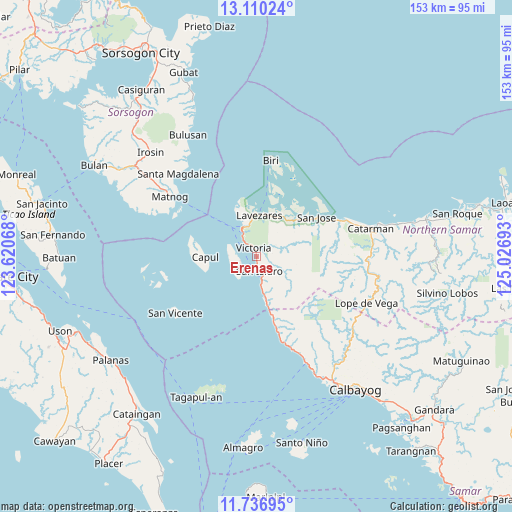
Erenas GPS coordinates[2]
12° 25' 28.2" North, 124° 19' 25.68" East
| Map corner | latitude | longitude |
|---|---|---|
| Upper-left | 13.11024°, | 123.62068° |
| Center: | 12.4245°, | 124.3238° |
| Lower-right: | 11.73695°, | 125.02693° |
| Map W x H: | 152.7×152.7 km | = 94.9×94.9mi |
| max Lat: | 20.78733° ⇑45.7% North |
| Erenas: | 12.4245° |
| min Lat: | ⇓54.3% South 4.65442° |
| min Long | Erenas | max Long |
| 117.04868° | 124.3238° | 126.58417° |
| W 76%⇐ | ⇒24% E |
Elevation
Elevation of Erenas is 6 m = 20 ft, and this is 81.9 m = 269 ft below average elevation for this country.
| Max E: |
2262 m = 7421 ft | 92.7% |
| Avg. | 87.9 m = 288 ft | |
| Erenas | 6 m = 20 ft | |
Min E: |
-2 m = -7 ft | 7.3% |
See also: Philippines elevation on elevation.city.
Geographical zone
Erenas is located in North Torrid zone (between Equator and Tropic of Cancer). Distance of this Northern Tropic circle is 1224.4 km =760.8 mi to North.| Distance of | km | miles | from Erenas |
|---|---|---|---|
| North Pole | 8625.6 | 5359.7 | to North |
| Arctic Circle | 6019.7 | 3740.5 | to North |
| Tropic Cancer | 1224.4 | 760.8 | to North |
| Equator | 1381.5 | 858.4 | to South |


Nearby cities:
15 places around Erenas: (largest is in red/bold)
• Alegria
2.9 km =1.8 mi,  175°
175°
• Allen
9.5 km =5.9 mi,  333°
333°
• Bobon
28.3 km =17.6 mi,  66°
66°
• Capul
15.5 km =9.6 mi,  269°
269°
• Jubasan
7.8 km =4.8 mi, 329°
• Lavezares
12.2 km =7.6 mi,  3°
3°
• Malaga
21.6 km =13.4 mi,  164°
164°
• Palanit
11.7 km =7.3 mi,  169°
169°
• Piña
27.3 km =17 mi, 162°
• Rosario
15.5 km =9.6 mi,  45°
45°
• San Antonio
5 km =3.1 mi,  255°
255°
• San Isidro
4.1 km =2.5 mi, 168°
• San Jose
21.3 km =13.2 mi,  56°
56°
• Victoria
2.9 km =1.8 mi, 331°
• Viriato
15.3 km =9.5 mi, 167°
Sources, notices
• [Note1] Compared only with cities in Philippines existing in our database
• [Src1] Map data: © OpenStreetMap contributors (CC-BY-SA)
• [Src2] Other city data from geonames.org with taken over terms of usage.
• [Src3] Geographical zone / Annual Mean Temperature by Robert A. Rohde @ Wikipedia
